New Zealand – A Day on the Routeburn Track

I was very lucky this January go to Australia as part of my day job, a free flight to the far side of the world was just too good an opportunity not to tag on a holiday to New Zealand, a place I have dreamed of visiting for over 20 years. Its very rare that you can build something up for that length of time and not be disappointed with the reality, but in this case I needn’t have worried, the country surpassed my expectations and it was a struggle to get back on the plane.

I spent my time exploring as much of the South Island as I could whilst trying to do justice to the places I was visiting. I left feeling I have only just scratched the surface of the most amazing places on earth.

My trip was too short notice to completely walk any of what New Zealand’s Department of Conservation (DOC) calls its “Great Walks”. These multi day hikes traverse some of the most spectacular landscapes the country can offer, mountains, beaches, and rainforest. To protect the fragile ecosystems accommodation is limited to official DOC sites which, in summer book up months in advance, wild camping is not allowed. There are however no restrictions on day hikes.

Routeburn (1 of 4)

The view down Lake Wakatipu

The Great Walk which I was most excited about was the Routeburn Track a 20 mile, 32km hike which starts just above Lake Wakatipu and the village of Glenorchy and finishes on The Divide (the high point on the road from Te Anau and Milford Sound). Although anyone used to hiking in Scotland could pretty easily knock that kind of distance off in a day to do so would really not do such a spectacular route justice and most people spend 3-4 days on the hike.  Another complication is that the ends of the trail are about 300km apart by road from the start so some careful logistical planning is required, for through hikers.

I left the Routeburn Shelter and for the first few hours found myself hiking through relatively level or gently climbing terrain surrounded by a lush rainforest full of birdsong. This was one of the most surprising things about my time in New Zealand, there was birdsong everywhere in the forests to an extent I have never heard in the UK, it was a joy to walk along to such a serenade. For a time the path follows a river as it plunges down of the hills in a spectacular series of waterfalls. After 6 km the track reaches the DOC hut at Routeburn Flats and begins to climb sharply to the higher and much better situated Routeburn Falls Hut at 9km, which sits seemingly perched on an outcrop at the treeline.

Routeburn (2 of 4)

Routeburn Falls Hut

The second half of the walk was a complete contrast, now above the treeline the hike threads its way through a steep sided valley filled with grasses and ferns, the mountains above, steep and craggy are also draped in green with thin waterfalls falling precipitously down their faces. The variety of plant and insect life along side the track was astonishing to someone used to hiking in the UK, indeed there were more flowers at the side of most New Zealand roads than I see during an average Lake District hike. One thing this trip certainly has done is made me realise what damage sheep and deer have done to the biodiversity of UK uplands.

Still climbing the path suddenly reveals a jewel of the route, Lake Harris, nestled below as if cradled by the mountains; the path traverses a majestic airy perch high above on the south side. A few Km further and about 15k from the start the path reaches the high point of the route, The Saddle, home to a small emergency shelter and a couple of long drop toilets, and if you are lucky a DOC ranger selling tea.

Routeburn (3 of 4)

Lake Harris and Conical Hill

From The Saddle the Routeburn Track turns south and drops into a different valley system, it’s a good point to stop and turn back if like me you don’t have anywhere booked to stay. If you have the energy I would recommend a short detour up Conical Hill, the peak that stands at the head of Lake Harris. Although only a little over a km, the path is very steep, and at points loose but the views from the summit are worth the effort, I was fortunate with a pretty clear day giving huge views in virtually every direction with no sign of roads, or human habitation.

With no place to stay on route this was as far as I could go and I reluctantly had to turn round and retrace my steps back to the car. Throughout the hike the path was excellent, and easy to follow, it would be difficult to get lost as the surrounding terrain is very challenging. I did the whole walk in trainers but boots would probably be more sensible if the weather is at all doubtful.

Routeburn (4 of 4)

A view back along the Routeburn Track from Conical Hill

Glenorchy Sunset (1 of 1)

Sunset in Glenorchy

Advertisement

Alpine Conditions in Assynt

The snow had consolidated to hard neve which crunched satisfactorily beneath my crampons as they bit greedily into the cold surface. Ahead the ridge narrowed and sharpened to a thin crest, the wind having scoured and carved the snow into a series of  curves and waves through which a single line of foot prints weaved.

My eyes followed the line of footmarks until they vanished, blended in with the ridge line as it wound its way towards my destination, the summit of Ben More Assynt lying about about a kilometre away. The panorama on all sides was glorious, heartwarming in that way spectacularly beautiful places cab be, that joy of being there in the landscape and experiencing its grandeur. The cold snowy early spring had left the hills in alpine condition, a series of snow capped peaks stretching on all sides below a blue sky dappled with bright white clouds.

Assynt Munros (4 of 5)

Conival from Ben More Assynt

Thoughts of yesterdays ten hour drive, half the length of the UK, instantly felt validated; worthwhile just to be here now in this landscape, looking down on the peaks of Assynt, its lochs, lochans, and rivers. Although distance makes my visits here rare this area, and the whole of the north west highlands has always been special for me, possessing a sense of wilderness, and space I don’t find anywhere else in the UK.

Although my objectives, Assynt’s munros Conival and Ben More Assent are spectacular hills in their own right they are somewhat overshadowed by their smaller neighbours like Suilven and Quinag which rank among the finest mountains in the country. Todays snow level at about 700m had however, made them the obvious target of someone seeking some a last chance to step on the crampons this winter.

Assynt Munros (5 of 5)

Conival (right) and Ben More Assent (left) and the linking ridge in profile

I had parked at Inchnadamph, and followed the access track and then the path along the northern bank of the River Traligill. Through much of the walk-in the summit of Conival loomed ahead, lost in cloud which was slowly beginning to break up under the morning sun to reveal its snow plastered western face broken by bands of black cliffs.

Where the river turns north east and dwindles to little more than a stream what had been a pretty good path became ill defined as it climbs steeply up the hillside towards a narrow band of cliffs. A dusting of light snow overnight had made the grass and rocks here slippy; and later when I was descending the thaw turned them potentially treacherous.

Assynt Munros (1 of 1)

Conical from the River Traligill

The cliffs, little more than steep broken rocks were easily breached bringing me out onto a broad flat alp and into a bitter northerly wind. Here the snow was well consolidated and I stopped to strap on my crampons before pretty much doubling back on myself to join the northern ridge of Conival which rose steeply up towards the summit.

As I climbed the panorama of the surrounding peaks began to reveal themselves, to the west Cansip and Quinag either site of Loch Assynt, with a thin blue line of the sea in the background. Further south Cul More and Cul Beag also rose out of the crumpled landscape of billion year old Lewisian Gneiss, their northern faces dusted with a covering of snow. Climbing higher I’m pretty sure I picked out Foinhaven and Arkle to the north and possibly An Teallach to the south, a fine collection of hills in any book.

In summer the ridge between Conival and Ben More Assynt can apparently be a boulder strewn chore, the winter blends these away under a covering of snow leaving it as a joy of airy exposure that was over far too soon. As I sat on the summit enjoying a warming coffee from my flask I could at least comfort  myself in the knowledge at least I needed to cross it again to get home.

Assynt Munros (2 of 5)

The view west from Conival, Cansip is just left of centre, Quinag on the far right and Cul More/Cul Beag on the far left.


screen-shot-2018-04-22-at-15-34-04-2-e1524408010461.png

Derwent Water Microadventure

I think winter is my favourite season, a proper winter that is, not a damp rainy winter the likes of which this time of year usually inflicts on the UK. Winter adventures this year have however been limited because of an opportunity to head to Australia and New Zealand with work, a chance that was far too good to miss.

Now back in the UK and with late February and March delivering cold conditions in spades  I was keen to get out for a bit of winter wild camping.  Most of my friends think I’m crazy camping in winter but I love it, its certainly nicer than camping in the rain. Temperatures below zero actually help keep kit dry compared to that horrible range between about freezing and +8 where its pretty impossible if its raining.

This does come with the caveat that you have to invest in a really good sleeping mat and bag to keep out the cold. I was also keen to try out my new shelter, a MLD Trailstar, a tarp like shelter from a small U.S manufacturer I had picked up just before Christmas and used for my trip round New Zealand. The Trailstar uses walking poles for support and is lightweight, but has a big footprint, is very weather proof and obviously well ventilated. I don’t intend to review it in any depth as many others already have.

Derwent Water Camp (2 of 2)

The Trailstar

Derwent Water Camp (1 of 2)

I use the Tarp with an Ooktub if there is a risk of wet ground

I pitched for the night above Derwent Water hoping to get some morning photographs over the lake towards Skiddaw from the Surprise View Lookout. Snug in my sleeping bag with a big bag of tea and a book I was able to slowly drift off to sleep with the winter winds whistling over the tarp. This is what I like about winter camping, the feeling of being warm and comfortable whilst being surrounded by cold crisp air. I slept well getting a good 10 hours sleep before the pre-dawn light began to diffuse through the tarp.

Roused from my bag and with a warming coffee in hand the wind had dropped to virtually nothing leaving Derwent water almost mirror still.  I spent a couple of hours at Surprise View and nearby Ashness Bridge, the sunrise didn’t clip the top of Skiddaw like I had hoped but I’m pretty please with the images I captured.

Ashness Bridge (2 of 2)

Ashness Bridge

Derwent Water Dawn - Suprise View (1 of 1)

Surprise view lookout

The Top Of Norway – Galdhoppigen

I’ll admit I was a bit nervous about climbing Norway’s highest mountain; the word “glacier” kept popping up in Google searches painting a picture of the vast sheets of white riven by crevasses that cover much of the Alps. My alpine trips, and the experience of friends had taught me that wandering about unroped on a glacier was a bad idea, the thought of my legs plunging through the snow into yawning nothingness whilst not attached to the security of a rope was deeply disturbing.

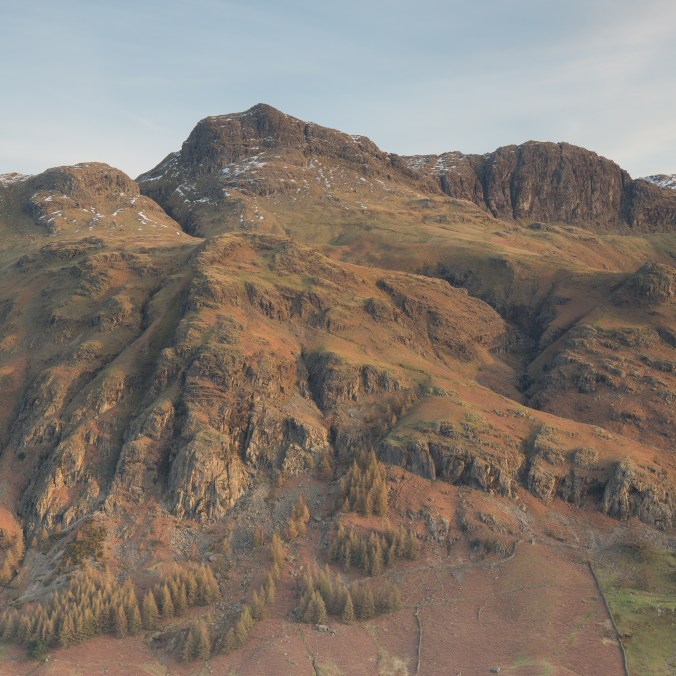
It appeared however that crevasses were not a problem on the route I was taking up Galdhoppigen, Norways highest peak, located in the stunningly beautiful Jotunheimen National Park. Although a sizeable part of the route was over the summit glacier it skirted its upper edge following the ridge line of the mountain. Indeed of the hundreds of people I saw on the mountain, I don’t think I remember a single roped party, indeed I appeared to be the only person to have bothered to bring any crampons.

Gladhopping (1 of 7)

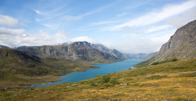
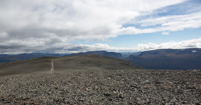
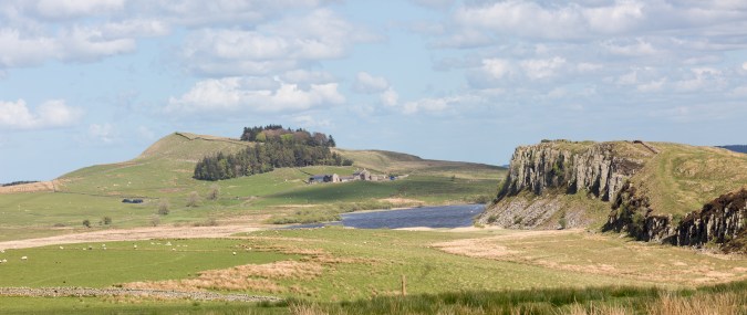
Looking into the park from the Mountain Station

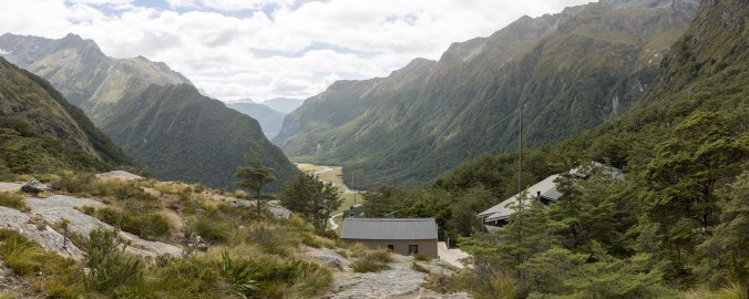
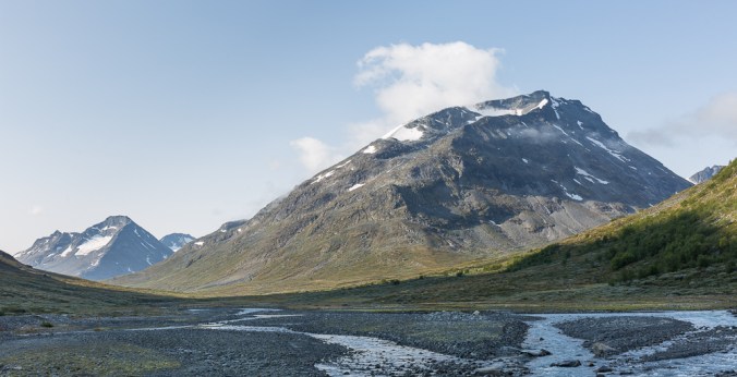
There are two main routes up the 2,469m peak, the first, and easiest (which apparently does involve a glacier crossing) is from Juvasshytta Mountain Station where the initial 1,841m of ascent can be done by car. I had chosen to start from Spiterstulen Mountain Station located considerably lower down the mountain, just 1,100m. The station is at the end of a long private road through a stunning sub arctic valley; the road initially winding its way though beautiful pine woods before breaking out into a broad u shaped valley, or scrub, moss, and boulders.

The station which offers accommodation including camping was still in shadow and bitterly cold when I arrived, but was already busy (parking fees apply) with people preparing for a day in the hills. Norway’s second highest peak Glittertind is also accessible from Spiterstulen making it a doubly popular base.

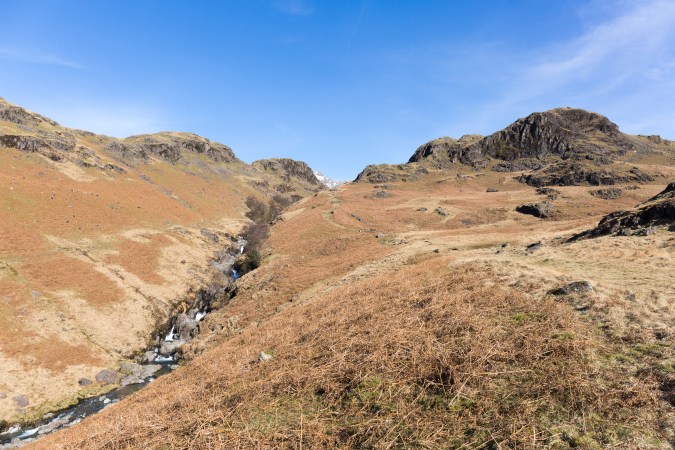
The route began through the campsite, climbing steeply through dwarf trees and bushes as it wound its way up the hillside, the trail was easy to follow but rough and not way marked, higher up it becomes very rocky, although earlier in the season much of this may be covered with snow.
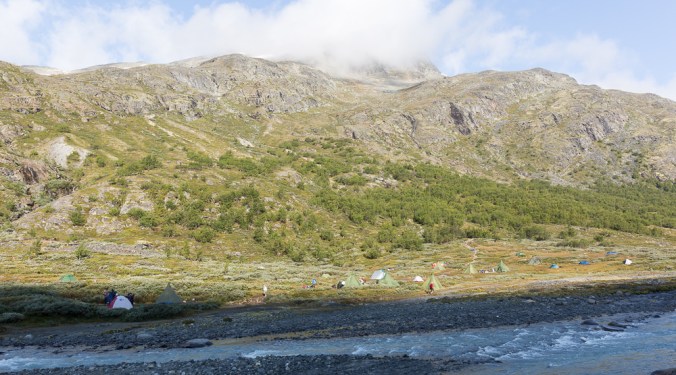
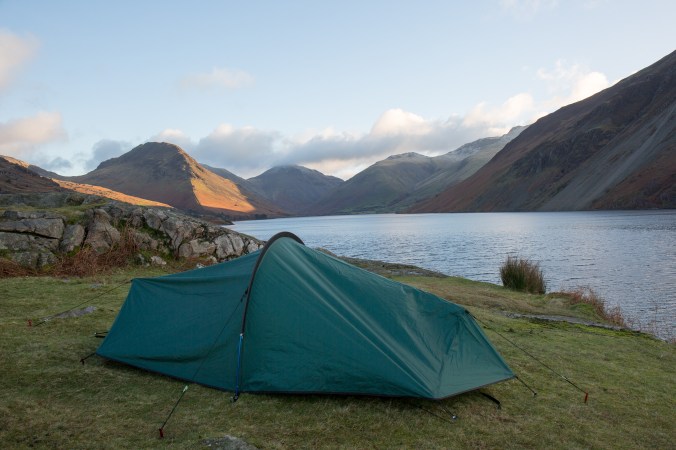
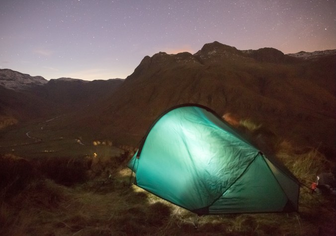
Gladhopping (2 of 7)

Camping

After about an hour I came across the first patches of snow, long furrows had been carved into them by the passage of hundreds of feet leaving a slippy surface that from watching others ahead of me clearly took some care to cross. Its always a judgment call when to put on crampons, is it a justified faff for 100m of snow? I work by the rule that I put them on if, either the consequences of a fall would be serious, or I’m likely to make up more time through the extra grip than I loose in the changeover.

Although relatively short I decided to put my crampons on at this point, and linking a number of patches together I was able to shoot past a number of groups and out onto a rocky plateau, from which rose a steep ridge of rock and ice, the first of two fore peaks   one must pass to get to the true summit.

Gladhopping (7 of 7)

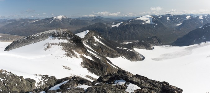
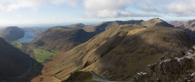
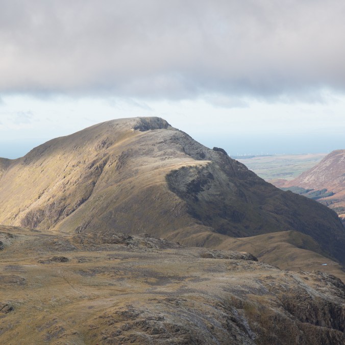
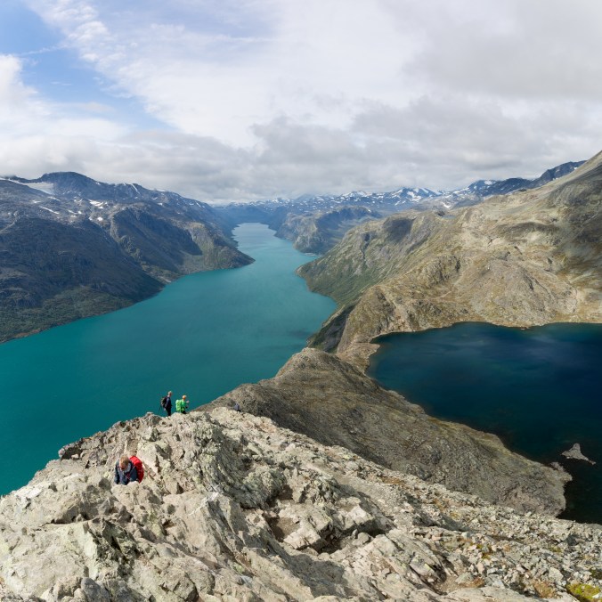
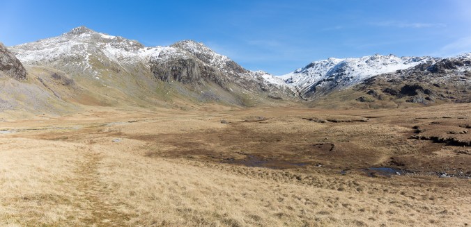
Looking back down the route from just below the summit. The route leaves from the valley in the distance and crosses the two peaks in the foreground making it a big day out.

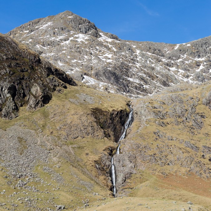
The next couple of km were challenging walking (particularly on the way down) even for those used to the more rugged Scottish peaks, rough rock and bolder hopping first up to the ridge and then up to the peak of Svellnose. Upon reaching the ridge the view opened out to the north, steep cliffs dropping down to a glacier stretching away in a brilliant sheet of white.

On the summit of Svellnose (which it is possible to skirt on the north side) I put my crampons back on as from here the next 2km to Galdhoppigen was almost entirely on snow and ice the first part of which was steep decent to the coll with Keilhaus Topp, the second of todays summits although little more than a notch on the ridge. The main summit gleamed in the sun, sparkling white in the distance, looking a considerable effort away.

Gladhopping (4 of 7)

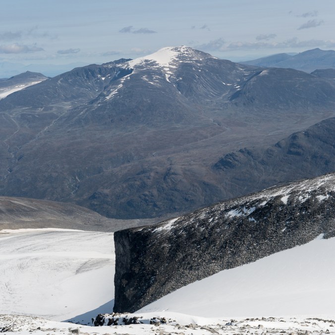
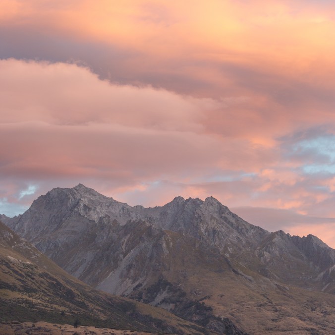
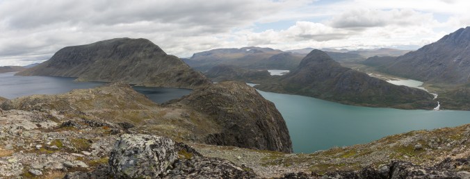
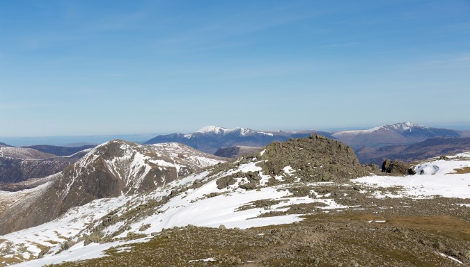
Glittertind from close to the summit

Now well above 2000m I was probably beginning to feel the effects of altitude but taking it slow and steady the final cone of the mountain slowly got closer and closer. Black dots resolved themselves into lines of people coming up the other route from Juvasshytta, and then my crampon spikes were crunching up the final few meters the top.

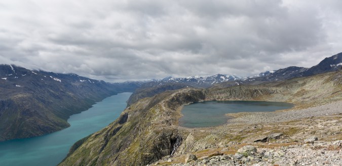
The views in all directions are superb, the cliffs, spikes, and spires of the Jotunheimen peaks spearing up out of the landscape of white snow and ice, like great molars and incisors of the earth. The view into the park is wild, and rugged, with some of the peaks  looking a severe mountaineering challenge. The summit was very busy with people enjoying a rest in the sun, and visiting the summit shelter which actually turns out to be a bar (no doubt the prices would be eyewatering even for Norway). It was such a nice day it felt good to linger on the summit taking in the view, there was little if any sign of human habitation just a vast panorama of mountains as far as the eye could see. there is certainly much more to explore here…

Note:

Overall the route from  Spiterstulen was about 13km with 1,500m of ascent. Although I saw nobody else with crampons I would recommend you take them, although the snow was soft when I climbed the peak I still saw two people fall over at the summit on ice. In addition the decent in particular was much faster in crampons
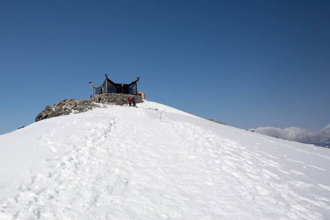
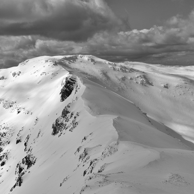
Gladhopping (6 of 7)

The summit

Wastwater Microadventure

I had not managed to get out and sleep under canvas in September or October missing out on camp’s surrounded by the beautiful colours of autumn. Motivation had been lacking, a prolonged period working away from home saw me arrive home late on a Friday tired, with a pile of washing and an empty fridge, this coupled with early starts on Mondays had sapped my energy. With the job complete I was therefore looking forward to getting out in the Lakes and an opportunity to wild camp.

I had chosen to head round to Wastwater, Englands deepest lake nestled below the seemingly vast screes of Illgill Head. Pitching up on a knoll just above the water I could look up the valley to Yewbarrow its south east ridge seeming to carve into the water like the great upturned prow of a ships hull, and beyond to Great Gable. This view is  arguable the most famous and iconic in the Lake District, even appearing on the logo for the National Park.

Wastwater (1 of 1)-3

I had hoped to get some sunset pictures but the clouds were unkind, offering up a dull sunset and I retreated to the warmth of my sleeping bag disappointed. Morning offered slightly better conditions and I found a couple of nice compositions with rocks in the lake mirroring the mountains in the background. For a time it looked like the rays of the rising sun would reflect off cloud which was dancing around Gable to light its snow dusted summit with warm pink and orange light, but it was one of those nearly moments you get so often in photography.

Wastwater (1 of 2)

Gable Sunrise

Wastwater (1 of 1)-2

A long exposure of some rocks

The sun rose to give a beautiful if cold morning, bright and crisp, making it any easy decision to hike up Gable and put a few miles in the legs.

Wastwater (1 of 1)-5

Wastwater and Kirkfell from Gable

Wastwater (1 of 1)-4

A light dusting of snow on Pillar

The Besseggen Ridge – An Adventure in Norway

Despite being the middle of August it had been a chilly night in the Jotunheim, clear skies causing temperatures to fall uncomfortably close to the transition limit of my summer sleeping bag, and leaving me thankful for the warmth of my down mattress. Over a warming morning coffee to get the blood flowing, I checked the ferry times for what must have been the fifth time, running over the calculations in my head again  convincing myself that todays hike would not end with me stuck at the far end of a lake with no way of getting back to my tent.

The ferry which runs up and down Lake Gjende is crucial to completing Norway’s most popular hike, the Besseggen Ridge in a day. The ridge forms the highlight of a 15km route that runs high above the northern edge of the lake between the DNT (Norwegian Treking Association) stations at Gjende and Memurubu.  Unlike most hikers who catch an early boat to start of the hike at Memurubu, I had decided to take the slightly more risky option and walk the other way, meaning I was relying on catching the last ferry back to base; going this way did however offer the best views and allowed me to tackle the ridge in decent.

Beggessen (1 of 1)

Lake Gjende

Beggessen (1 of 7)

Rainbow

The bustle of the DNT tourist station was quickly hidden as the trail weaved its way steeply up the hillside; a fresh wind causing streamers of white to dance over the surface of the blue lake, blowing in a squall of rain to cast a rainbow against the distant clouds. The lake itself stretched into the far distance and narrow sliver of blue nestled between steep mountains, cliffs and crags.

The Jotunheim contains more mountains above 2000m than anywhere else in northern Europe and reminded me very much of the Cairngorms but on a much large scale. As hight is gained above the valley floor the trees and bushes give way to grass and moss, before these too give up the struggle against the elements leaving just lichen to splash itself over the carpet of shattered rock; its a testament to the harsh conditions against which life must fight this far north.  Besieger’s summit is a gently undulating plateau offering great views over the peaks which surround it on all sides, with snow patches and small glaciers plastered to the flanks of the higher mountains.

Beggessen (2 of 7)

Looking over the Jotunheim

Beggessen (3 of 7)

The summit plateau

The plateau gradually narrowed, becoming hemmed in by steep cliffs on both sides, the ridge however remained hidden until the last minute with the view ahead dominated by the bulk of the peak of Besshoe. Then suddenly the ground vanishes before you, plunging downward towards a hanging valley filled by a lake who’s dark blue waters contrast vividly with the turquoise of Lake Gjende. The lakes, although seemingly only a good stone throw apart are actually separated by something between 200 to 300m difference in altitude.

It’s a fantastic view fully justifying the walks popularity, although how much the ferry load of people who I ran into at this point hiking east from Memurubu got to appreciate it I’m not sure, as whilst climbing up the ridge the best view is to their backs.  Technically the decent was pretty easy, the ridge is not as narrow or exposed as many of the UK classics such as Crib Goch, or possibly even Striding Edge and I  only need to use my hands fleetingly at the steeper sections.

Beggessen (4 of 7)

The view from the start of the ridge

Beggessen (5 of 7)

Looking back at the ridge

Although the highlight of the route the walk is far from over once you get off the ridge, you are actually only about half way to Memurubu although the path from here is easy to follow and contains no real further difficulties as it weaves its way over the shoulder of Besshoe. The terrain in the second half of the hike is more varied weaving up and down giving constantly changing views out over Gjende and into the more remote higher mountains deep in the interior of the park.  The landscape is expansive, a network of rivers, lakes and waterfalls, looking back the Besseggen ridge looks sharp, prominent, and inviting.

As the afternoon wore on cloud began to build and shrouded the tops of the higher peaks and I was relieved to have caught the best of the weather for the most picturesque section of the hike. As I approached Memurubu a series of signs warn hikers travelling the other way (east) that if they have taken more than a certain amount of time to get here they should turn around and head back otherwise they risk not finishing before nightfall. AS I don’t pass anyone on the remainder of the hike I can assure that the signs either work or the Norwegians are all far to fast to ever get caught out like that.

The decent to the DNT station is steep and actually  quite unpleasant with lots of loose rock to slip on, its eroded to the extent it would almost certainly get fixed if it were in the UK, but from my limited experience of hiking in Scandinavia, heavily engineered paths are uncommon.

Making good time I arrived well over an hour before the ferry was due so was able to have a good look round the station which comprised a series of huts including a restaurant (where I’m sure I could buy a very expensive beer), and a lovely campsite down by the waters edge. For walkers heading west therefore missing the ferry would not be a complete disaster as food and accommodation is available. For me though, I  have a date with some Swedish beer back at the campsite (having been advised to stock up before crossing the border and thus avoid having to take out a small loan to buy alcohol in Norway)!

Beggessen (6 of 7)

A small tarn by Norwegian standards


Hadrian’ Wall Microadventure

What must it have been like to stand and stare out across the edge of the world? From the wall the hills roll away to the horizon, carpeted with a sea of trees, a dark forest that stretches north into a land of barbarians. I can imaging the soldiers brought here from the four corners of the empire, be it Gaul, Macedonia, Turkey, or Africa; what must they have made of the thin ribbon of stone hewn out of the landscape at the edge of civilisation that was now their home.

Hadrian's (4 of 1)

My tent it pitched for the night in the ruins of Milecastle 39, high in the Northumberland Fells where Hadrian’s Wall runs perched upon the outcropping Whin Sill. Reaching out and touching stones placed 2000 years ago by unknown hands is exciting, the wall itself  still an inspiring presence in the landscape.

I’ve always been fascinated by the engineering genius of the Romans; it’s not just the sheer ambition and scale of their buildings, but also the precision of the construction. Then there is the incorporation of “modern” technologies such as running water for sanitation or hypocausts for central heating, ideas that would be forgotten in the west for almost 1500 years after their civilisation fell.

There is the Pantheon in Rome whose vast dome has stayed standing for almost two millennia with no reinforcement just an exquisite understanding of how forces can be balanced; or the 50m high Pont du Gard aqueduct in the south of France surveyed and built to such accuracy that it falls a mere 2.5 cm in its 300m length.

Hadrian's (1 of 2)

Hadrian’s Wall even in its prime would never have had the beauty of these structures as it was built to be functional; to keep out, or control the Celts whom the Roman army had been unable, or unwilling to conquer. Today the ruins, ageing softly and gently into the landscape give echoes of its former presence, nowhere better than here where the Roman engineers made use of the cliffs formed by the Whin Sill.

To sleep in a milecastle – unsurprisingly placed every mile on the wall – had been something I’d really wanted to do; a way to link back to a time when there really was an edge of the world and one could stare out over land about which little was known.

Hadrian's (2 of 2)

Bedding down in Milecaste 39 listening to the wind whip round the tent my mind drifted to thinking about the soldiers who once called this place home. The men were drawn from across the Roman world, from Europe, Africa, and as far east as Syria, brought here to protect this wild part of the empire. What was this place like on a summer day all those years ago, standing on the wall as the sun set beyond the far hills? Did they struggle for warmth on a cold winter night or did a roaring fire banish the chill as the snow beat against the castle walls?

Roman soldiers probably saw more of the world than many of us do in the jet age; the only way here was to walk, from Spain, from Croatia, from somewhere, across the largest empire the world had known. Did they ever stop thinking what was beyond that far horizon, beyond the edge of their world, or did their thought turn back to the long road home?

Robin Hood Tree (1 of 1)Hadrian's (3 of 2)

A Glorious Day in Eskdale

Until this trip I had never visited Eskdale; a mixture of laziness and familiarity with the more easily accessible surrounds of Borrowdale, Langdale, Patterdale, and the other eastern honeypots of the Lake District must have caused my eyes to flash over that mass of tightly knotted contours on the map.

Actually that’s not quite true, I do remember diving the Hardknott Pass just after passing my test driven by some twisted logic that as it was the steepest, and therefore hardest, road in the UK, I must immediately challenge myself against it. Having made it back down the 33% hairpins with brakes and body panels intact I promptly forgot about it until recently when the thought of a long rambling approach to Sca Fell came to mind.

Eskdale-2

The Esk tumbles down from the Great Moss

Well I’ve been missing out, Eskdale is glorious!  I’m sure it was partly the stunning late winter high pressure weather, a cloudless blue sky and snow dappled peaks that brought out the best in the landscape, but, Ennerdale aside I don’t think I have felt so remote in the Lakes so quickly after leaving the car.

My route took me from Jubilee Bridge along side the Rive Esk with its myriad of waterfalls and deep plunge pools, perfect for a bit of wild swimming, up onto the Great Moss a broad valley ringed by high peaks. Here there is little if any sign of human habitation, a little piece of wilderness with faint paths and bridge-less rivers to be forded more like Scotland than one of England’s busy national parks.

Eskdale-5

The Great Moss

From the Moss I scrambled up alongside How Beck Falls (Cam Spout) which cascades in a series of steps down the steep hillside (and is now firmly on my winter tick list). Above the waterfall the path climbs up towards Mickledore and Broad Stand but before reaching this I turned left up a narrow gully to Foxes Tarn and a steep pull op scree to the summit of Sca Fell.

Patches of hard snow covered the summit with deep post holes from accents under more challenging conditions forming an easy staircase up the last few meters. For a few precious minutes after arriving I had the summit to myself and was able to enjoy view of snowcapped mountains out to the horizon. Skiddaw and Blencathra where prominent to the north, their peaks dusted with white above the greens and browns of the valleys below. To the west the sea stretched out to the horizon with the Isle of Man visible in the distance.

Eskdale-6

Cam Spout

I had seen nobody on my long walk up, enjoying the isolation and the chance for a skinny dip in the river, and now was somewhat shaken out of my solitude by the arrival of about 40 hikers within 5 minutes who had all made their way up the southern ridge of the mountain. This somewhat threw me out of my reflective mood and I beat a hasty retreat back town towards the Moss.

I have not enjoyed a day in the hills more for a long time, and wonder what else I’ve missed so close to home.

Eskdale-10

Mickledore

Eskdale-13

Skiddaw and Blencathra

Langdale Microadventure

With the mountains of the Lake District still capped with spring snow I plodded up to the top of Side Pike as darkness quickly descended around me. Fortunately it was not too steep a climb carrying full overnight and photography kit; the hill is diminutive but boasts fantastic views over the Langdale Pikes which was why I had chosen it for the weekends wild camp. I managed to get the tent set up with the last rays of warmth fading from the sky, pleased I have brought my winter sleeping bag with me as the clear sky suggested and delivered a cold night.

Tent

As tea cooked on the stove the stars bust into life throughout the blackness above, Orion and Sirius prominent to the south, and I spent about an hour trying to capture a tent lantern picture; something I have seen others do but which I found to be quite a challenge, juggling camera settings and trying to focus in darkness.

After a good nights sleep I woke to a brilliant sunrise; a warm glow on the hills which gave way to the first rays of sunlight catching the white snow and then dappling the upper slopes of the Lansdale pikes with a gentle morning light.

Langdale-4

Langdale-2Langdale

In Search of Perfection – A Traverse of Liathach

It’s a day that will probably be seared into my memory till the day I die, a day which sparked a fire of enthusiasm and passion for adventure; the day I fell in love with mountains, the Highlands, and winter climbing. The moment of Damascene conversion, when I decided that I wanted to spend my life exploring mountains occurred during climbing the last few meters of a steep snowy grade I gully on the north side of Liathach, a sandstone colossus in Torridon.

torridon-4

A perfect winter day.

It was all a new experience, the excitement of climbing the firm neve with walls of back rimed rock towering above on either side, working slowly up, towards a clean, sharp dichotomy, as the white of the gully met a slot of blue sky. Those final few meters were a stunning contrast, emerging from the narrow defile of the gully onto the summit ridge and into an immense feeling of space. The Highlands were spread out before me, under a brilliant blue sky snow capped mountains stretched away to the horizon in all directions, great towering castles of Torridian sandstone steep, and seemingly impregnable, yet here I was standing on a gossamer thin ridge, dancing above the Earth as the south face of Liathach fell away steeply into the valley.

Although now fifteen years ago I remember it vividly, perhaps it’s all the sharper because I have no photographs of the day to dull the ardor for the memory, nothing to suggest that in reality perhaps the sky was not quite so blue, or the snow not quite so brilliantly white. For a first experience of winter climbing I could not have asked for more, yet I was to learn quickly that such days are rare, the Highlands in winter are fickle, and for every perfect day the great engines of ocean and atmosphere that drive our weather deal many Jokers  from their pack.

torridon-6

Beinn Alligin and Loch Torridon

That day in 2002 we did not actually climb either of Liathach’s two Munro summits Mullach an Rathian and Spidean a’Choire Leith, but traversed the ridge to the eastern top of Stuc a’Choire Dhuibh Bhig before retreating back down the gully, the main summit a step too far for a party of novices on their first trip and shattered from fighting through deep snow lower down.

Needless to say Liathach was unfinished business to me, I have visited Torridon a few times since, drawn by the beautiful triptych of Liathach, Beinn Eighe, and Beinn Alligin. The twin munro summits of the latter two peaks fell at intervals over the years, but never under conditions anything like those I remembered from that first love, sometimes I had snow and mist, sometimes it was snow and rain, but never was there a hint of weather that could do justice to that memory I held so close to my heart.

torridon-9

Beinn Eighe, beyond Liathach’s summit ridge. The eastern top visited in 2002 is at last

I guess you can sometimes hold your dreams too tightly, to the extent you snuff them out whilst waiting for them to be perfect.  Fifteen years of trying to line up weekends, weather, snow, and other commitments can make you begin to ask if the stars will align again, yet still that memory is so strong that you can’t risk sullying it with disappointment. It’s a catch -22 which make it easy to find something not quite right and a reason to postpone the trip.

This month I slew that dragon. Taking a chance on a good but not perfect forecast, excepting the risk of disappointment; and, in traversing Liathach under brilliant blue skies had one of my best days in the hills. The snow may not have been as deep as in 2002 but as I climbed onto the ridge just below Mullach an Rathain the great expanse of Wester Ross, hidden till the last few steps was revealed rolling away towards to the sea. In that instant, something inside me leapt with joy just as it had those 15 years ago.

There are other beautiful moments in time, you just have to go out and find them.

torridon

Beinn Alligin (left) and Beinn Dearg from just below the summit