I was very lucky this January go to Australia as part of my day job, a free flight to the far side of the world was just too good an opportunity not to tag on a holiday to New Zealand, a place I have dreamed of visiting for over 20 years. Its very rare that you can build something up for that length of time and not be disappointed with the reality, but in this case I needn’t have worried, the country surpassed my expectations and it was a struggle to get back on the plane.
I spent my time exploring as much of the South Island as I could whilst trying to do justice to the places I was visiting. I left feeling I have only just scratched the surface of the most amazing places on earth.
My trip was too short notice to completely walk any of what New Zealand’s Department of Conservation (DOC) calls its “Great Walks”. These multi day hikes traverse some of the most spectacular landscapes the country can offer, mountains, beaches, and rainforest. To protect the fragile ecosystems accommodation is limited to official DOC sites which, in summer book up months in advance, wild camping is not allowed. There are however no restrictions on day hikes.
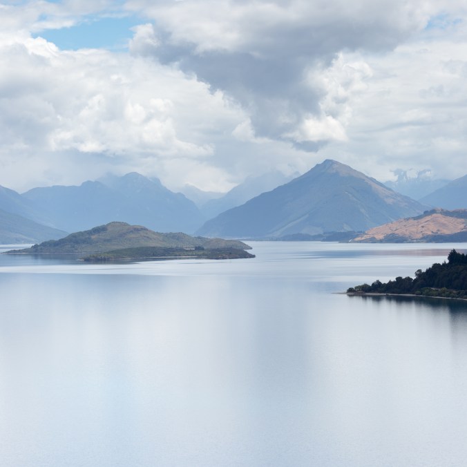
The view down Lake Wakatipu
The Great Walk which I was most excited about was the Routeburn Track a 20 mile, 32km hike which starts just above Lake Wakatipu and the village of Glenorchy and finishes on The Divide (the high point on the road from Te Anau and Milford Sound). Although anyone used to hiking in Scotland could pretty easily knock that kind of distance off in a day to do so would really not do such a spectacular route justice and most people spend 3-4 days on the hike. Another complication is that the ends of the trail are about 300km apart by road from the start so some careful logistical planning is required, for through hikers.
I left the Routeburn Shelter and for the first few hours found myself hiking through relatively level or gently climbing terrain surrounded by a lush rainforest full of birdsong. This was one of the most surprising things about my time in New Zealand, there was birdsong everywhere in the forests to an extent I have never heard in the UK, it was a joy to walk along to such a serenade. For a time the path follows a river as it plunges down of the hills in a spectacular series of waterfalls. After 6 km the track reaches the DOC hut at Routeburn Flats and begins to climb sharply to the higher and much better situated Routeburn Falls Hut at 9km, which sits seemingly perched on an outcrop at the treeline.
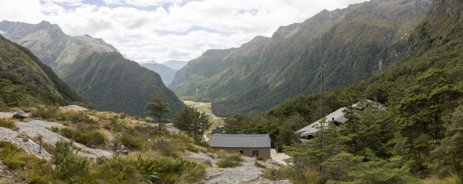
Routeburn Falls Hut
The second half of the walk was a complete contrast, now above the treeline the hike threads its way through a steep sided valley filled with grasses and ferns, the mountains above, steep and craggy are also draped in green with thin waterfalls falling precipitously down their faces. The variety of plant and insect life along side the track was astonishing to someone used to hiking in the UK, indeed there were more flowers at the side of most New Zealand roads than I see during an average Lake District hike. One thing this trip certainly has done is made me realise what damage sheep and deer have done to the biodiversity of UK uplands.
Still climbing the path suddenly reveals a jewel of the route, Lake Harris, nestled below as if cradled by the mountains; the path traverses a majestic airy perch high above on the south side. A few Km further and about 15k from the start the path reaches the high point of the route, The Saddle, home to a small emergency shelter and a couple of long drop toilets, and if you are lucky a DOC ranger selling tea.
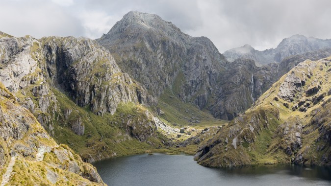
Lake Harris and Conical Hill
From The Saddle the Routeburn Track turns south and drops into a different valley system, it’s a good point to stop and turn back if like me you don’t have anywhere booked to stay. If you have the energy I would recommend a short detour up Conical Hill, the peak that stands at the head of Lake Harris. Although only a little over a km, the path is very steep, and at points loose but the views from the summit are worth the effort, I was fortunate with a pretty clear day giving huge views in virtually every direction with no sign of roads, or human habitation.
With no place to stay on route this was as far as I could go and I reluctantly had to turn round and retrace my steps back to the car. Throughout the hike the path was excellent, and easy to follow, it would be difficult to get lost as the surrounding terrain is very challenging. I did the whole walk in trainers but boots would probably be more sensible if the weather is at all doubtful.
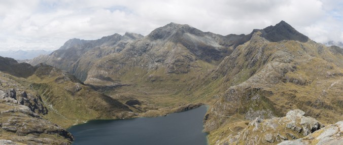
A view back along the Routeburn Track from Conical Hill
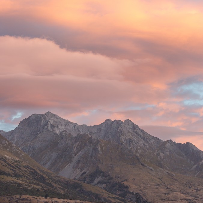
Sunset in Glenorchy
