Packrafting in the Western Lakes

Although I’ve managed to get out quite a lot with my packraft this summer, I haven’t really been adhering to the main concept behind the boat. Focused on exploring the islands and hidden bays of the Lake District I’d yet to actually carry my boat anywhere, thus negating possibly its primary design feature – its lightweight and compact flexibility.

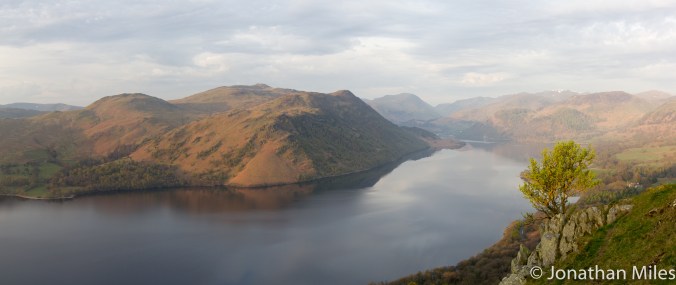
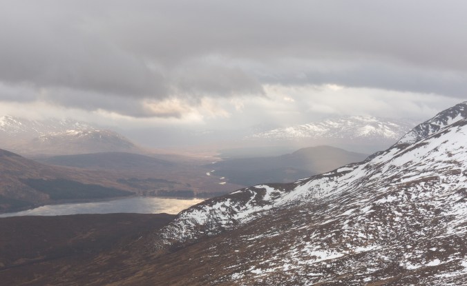
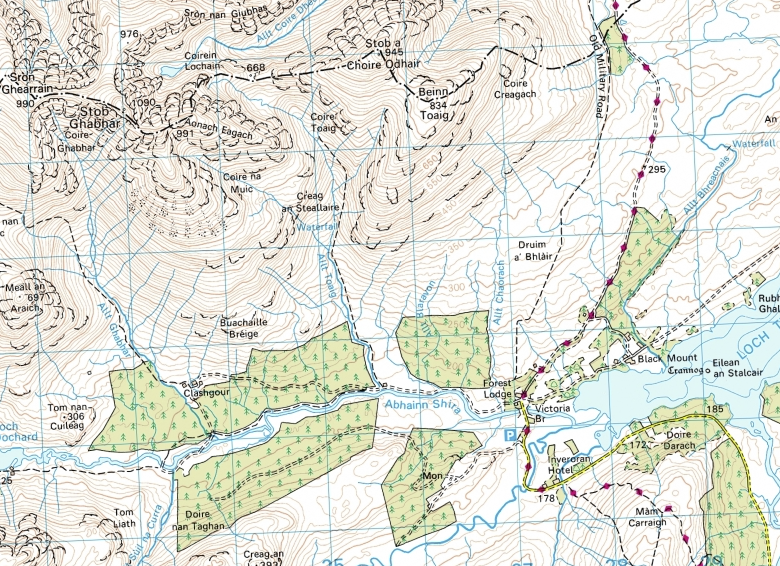
The lakes of the western Lake District radiate out like the spokes of some giant wheel with its hub centred somewhere around the craggy bulk of Great Gable. This arrangement suggested an easy way to link up Buttermere and Carrock Water with Ennerdale Water, the lakes providing smooth passage through the valleys which could   then be joined togeather with hikes over the passes between the mountains.

I covered the ground it two days, but the route would also work well over three at a more relaxing pace leaving time to swim and explore the various lakesides, especially in little visited and virtually traffic free Ennerdale. Starting points are possible from the southern tip of both Ennerdale and Carrock Water, plus from Buttermere itself.

20190824_193738

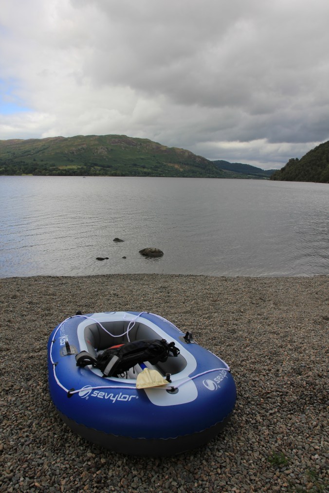
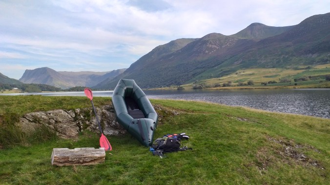
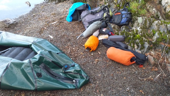
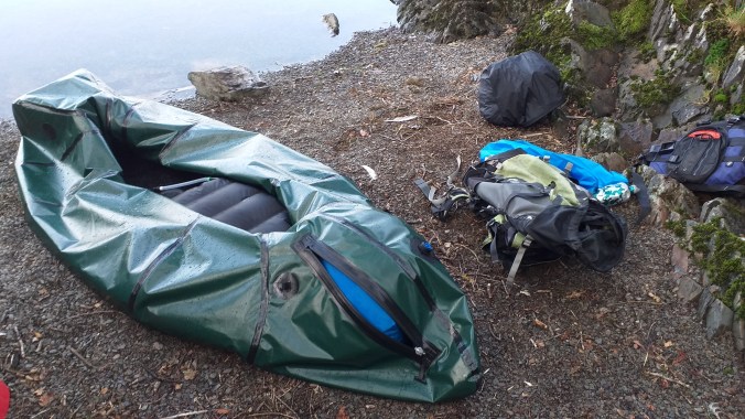
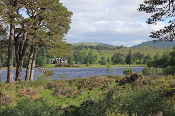
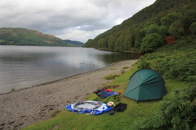
The Camp beside Currock Water

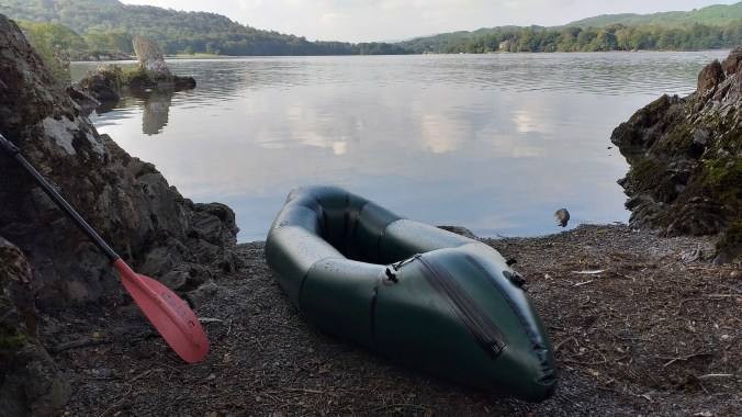
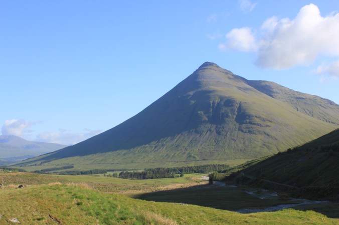
I started on Carrock Water which was close to mirror still as I paddled across its surface, the vast bulk of Grasmoor, its slopes dark purple with late summer heather reflected clearly in its surface. Although I’m still new to packfrafting I’ve already learned to enjoy these calm conditions when they present themselves, when the boat appears to skim over the surface, gliding silently through the still water.

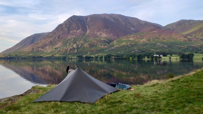
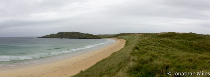
My target for the evening was the short spur of Low Ling Crag, which juts out like a miniature peninsula from the western side of the lake offering a little level campsite surrounded on three sides by water. The location is spectacular with great views up and down the lake, Fleetwith Pike dominating the valley head in one direction, Grasmoor looming large in the other. I pitched facing the latter, and following a short and very cold swim enjoyed the changing colours cast by the setting sun on its slopes.

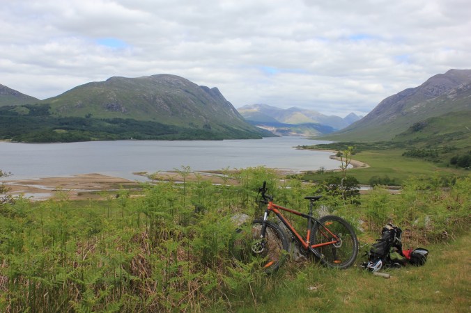
With morning I broke down the raft for the hike over to Ennerdale. My Alpaka Caribou weighs little more than 2kg and packs into a roll about the same size as a winter sleeping bag making it easy to fit in a medium sized rucksack along with lightweight camping and hiking kit. My paddle is lightweight plastic and carbon fibre and splits into three making it easy to strap onto the side of a rucksack. I was really pleased with how little everything weighed, important if considering a long hike or steep climb. The only item which did not pack down well was my buoyancy aid which by their nature need to be pretty bulky.

20190824_182231

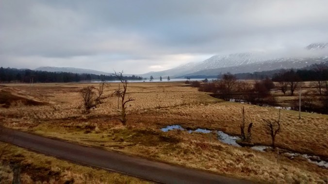
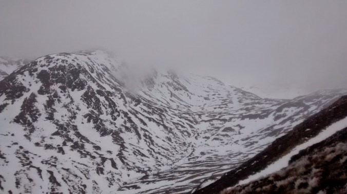
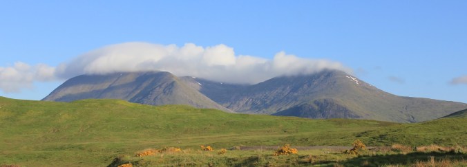
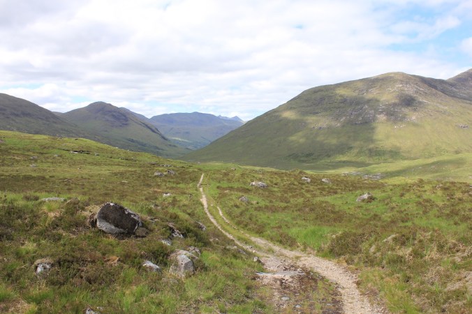
With everything packed I hiked up past the beautiful hidden waterfall of Scale Force and into wild Mosedale which feels much more remote than most of the Lakes, following a faint path winding through the boggy, tussocky grass. The path, which is probably a boggy mess in winter, continues to climb up to Whiteoak Moss and Floutern Tarn before dropping down to meet Ennerdale Water after about 7km of hiking.

I found a small beach by the lake and inflated the raft, two kayakers passed by heading up the lake down which a strong wind was now blowing. Battling against this it was a slow but beautiful paddle up the valley, I followed the northern bank past Bowness Knott with the wind wafting the smell of the pine trees across the water as the sunlight sparkled off the waves whipped up by the wind.

From the water I spotted plenty of camping spots hidden in the trees, perfect stops if you felt like taking your time over the trip. A couple had tents in situ, kayaks drawn up on the beach below their owners obviously enjoying a lazy day in the hot sun. The lack or roads and cars makes Ennerdale a quiet valley, putting off those unwilling to be separated far from there vehicles, and I caught glimpses of relatively few hikers making their way through the trees as they headed up the valley.

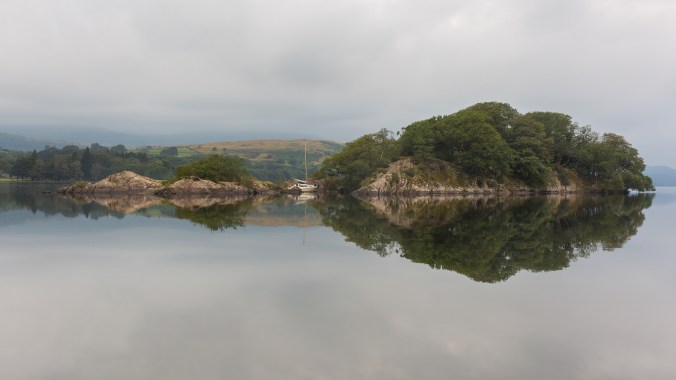
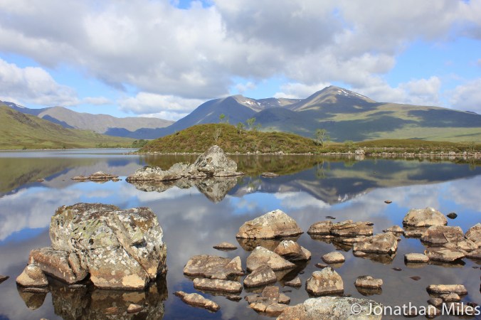
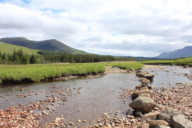
Reaching the upper end of Ennerdale Water I explored the River Liza where it enters the lake, the water was shallow and crystal clear but progression upstream was impossible due to many small rapids. Landing, and before packing up the boat again, I swam (much warmer here) and ate lunch whilst drying myself in the warm sun.

20190825_112032

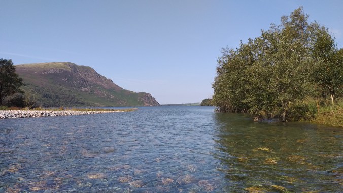
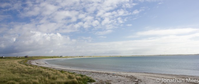
Looking down Ennerdale Water from the mouth of the River Liza

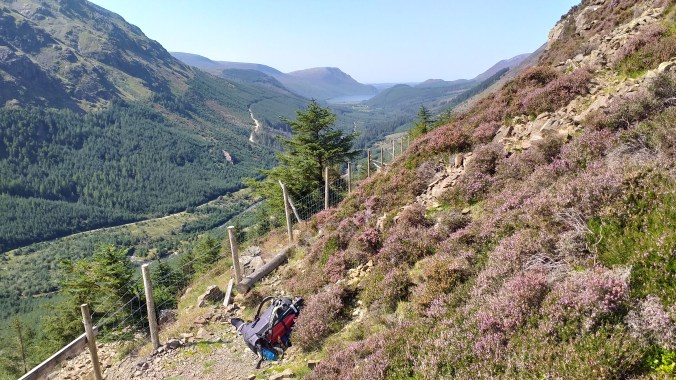
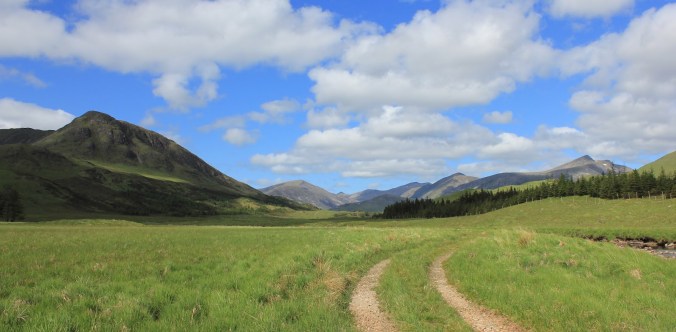
My route back to Buttermere headed  up the valley following the river before turning north and climbing over the Scarth Gap Pass. For most of the way the route is easy following the access track which leads to the YHA’s Black Sail Hut which is located at the head of the valley (another possible overnight option). Rather than hike to the hut and take the bridleway to the pass I left the track a couple of km short and followed a footpath diagonally up the hillside, the going was rocky and steep but the views back down the valley were spectacular.

At the pass I join the bridleway climbing up from Black Sail and was suddenly surrounded by crowds exploring the fells above Buttermere. I’ve seen the Scarth Gap Pass described as a mountain biking link between the two valleys, and had thought of the route as a bike / packfraft combo. The contours covered by the bridleway put me off and I’m glad they did, the decent to Buttermere was technical to unridable and would have been a complete nightmare with heavy kit.

20190825_133724

Reaching the lake I re-inflated the raft and pushed off from the busy shore for the final (almost) section of paddling to complete the circle. Buttermere is linked to Currock Water by a small river about 1km long called the Buttermere Dubs, this offers a potentially  easy link between the two lakes without having to break down the boat.

Although the river looked to have no real technical difficulties in terms of white water it was overhung by a lot of trees which dropped right down to water level forming a series of strainers, especially close to the bridge half way down. These would require some precise control of a raft to avoid and as there was a reasonable flow when I inspected  the run and as I’m still learning the capabilities of both the raft any my ability to control it I decided to portage.

Both Buttermere and Currock Water were thronged with people enjoying the Bank Holiday sun, but as if by magic all I had to do was paddle a few 100m  out from the shores to drift back to a more tranquil setting, the hubbub on the back drifting into the background and only intruding on the periphery of senses. Not feeling under any time pressure, I slowly paddled back towards the car thinking about where my boat could take me next.

Advertisement

Microadventure 17: Wildcamp off Wildcat Island

20190803_182149

Is there anything nicer than an early morning swim in a warm still lake? The surface of Coniston Water is a mirror reflecting the surrounding hills as I swim out from the small beach above which I pitched for the night. The water is lovely, warmed by the sun over the past few weeks its at that lovely sweet spot of being warm enough to be pleasant but cool enough to be refreshing.

Peel Island is famously the inspiration behind Wildcat Island, a place of adventure and exploration in Swallows and Amazons. I had paddled over in my packfraft the day before with the intention of camping overnight on the island, however having explored the nearby shore I found a lovely spot hidden amongst oak trees above a tiny gravel beach.

I was using my Alpaka Caribou cargo fly for the first time and must admit to being slightly nervous. This is a rather neat storage solution where you keep all your camping kit inside the inflatable section of the raft itself. This obviously means access is required so Alpaka installed a half meter long air tight zip in boat. Whilst to me this seams rather worrying I have to admit its working fine so far, and certainly leaves the cockpit area much less cluttered than otherwise.

20190804_082425

Yes That’s a zip in the raft!

My campsite is lovely but within 10m of where I have pitched I find evidence of 4 fires, this appears to be becoming more and more of an issue as wild camping becomes more popular, and I’m not sure of an easy way to educate people against it.  With the shelter up, I  wade out into the lake for a swim out to Wildcat Island for an explore.

The lake is busy with swimmers, paddlers, and the odd boat making their way here and there. The island is a focal point for stopping for a bite to eat, but although it’s small I find a corner to a relax in the sun before swimming back to my campsite.

20190804_082750

In it Goes!

The following morning I’m up at six hoping for some nice sunrise photos; it’s perfectly  still giving lovely reflections in the surface of the lake but unfortunately also overcast. I play around with my camera for a bit then because its super early on a Sunday strip off for a skinny dip.  

It’s lovely swimming out from the beach into the undisturbed water, the visibility looks great and I make a note to invest in a snorkel so I can see whats going on below the surface. Ten minutes into my swim and it starts to rain causing the surface of the lake to jump wildly around me, a delightful experience.

I’m becoming completely sold by camping via packfraft, I can’t wait to take it to Scotland and explore the lochs.

20190804_083324

2019_003-62

Peel “Wildcat” Island

Not Quite Winter on Carn Liath and Beinn Udlamain

Those few days between Christmas and New Year are often a holding pattern between the consumption of too much food and the consumption of too much alcohol. As the days are mandatory holidays for me, and I had just about worked through the myriad of snacks that accompany the festive celebrations it seamed like a good idea to head somewhere for a few days in the hills to address the calories in the bank so to speak.

I’m particularly inspired by climbing and walking in Scotland in winter, drawn by the thought of peaks and ridges capped with crisp snow set against a blue sky. As someone who lives 400 miles away from the Highlands I tend to view weather forecasts around my windows of opportunity in my work calendar through slightly Quixotic glasses and possibly myopic fashion, always hoping conditions will be slightly better than advised!

By Boxing Day however any optimism I may have held about a few days on the west coast had been battered into submission by storms Barbara and Conor and my hope of a to north looked to be fading. Looking for a straw to grab a hold of a few pictures glimpsed on Twitter of snow settling around Loch Morlich convinced me that the Cairngorms could allow me to snatch a few days wintering before heading back to work.

blog4

Looking for the summit

Four hundred miles later and it was clear that the skis, crampons, and axes were going to stay in the car as temperatures rose rapidly to high single digits, bringing wind and cloud to dominate the forecasts. Rather than use my time to slog up a gully full of soft rapidly melting snow I decided to use my time to visit two  Munros I’ve missed during previous trips that would otherwise get overlooked as I slowly work through the remaining 200 on my to do list.

Beinn Udlamain (1011m) is one of four rounded hills that lie just west of the A9 at the Drumochter summit, all four are a reasonably reliable ski tour with snow often down to road level and I had been able to pick three of them off like that during earlier trips. Beinn Udlamain lies farthest from the road and had therefore been left till last. In good weather experienced ski tourers (which I’m not) could easily link together at least two and possibly all the summits without too much difficulty.

With a light pack, not requiring much usual winter kit, I followed the landrover track from the A9 up Coire Dhomhain, the head of which was lost in a opaque  ceiling of grey cloud. Reaching an obvious stream coming down from the coll between Beinn Udlamain and  A’ Mharconaich I turned up a stiff climb over grass and hether but very little snow.  Higher up there was a covering of the white stuff, which in the cloud brought a virtual whiteout and disconcerting slog up into nothing.

Finally the seeming interminable white slope gave way to a rounded broad ridge clear of snow which I could follow via a couple of doglegs (and well spaced old fence posts) to the summit after just over a kilometre.

15747412_10100427264243069_3876748215602161377_n

One of those days!

blog2

Cloud banks above the Sow of Atholl

With the summit shrouded in grey mists Beinn Udlamain lived up to one translation of its name, the “gloomy mountain”; although to be fair to it, in climbing its three neighbours Geal-chàrn, Sgairneach Mhòr and A’ Mharconaich I’ve never been able to see more than about 100m on any of the summits missing what must be good views across to Ben Alder and Loch Erict.

The second peak I picked off was Carn Liath which lies above Loch Laggan and is often climbed with (and probably overshadowed by) Creag Meagaidh a fantastic mountain with, in my opinion the finest winter coire in Scotland in Coire Ardair.

The route (faint path) left the excellent path to the coire just before it enters the woods and climbs steeply up onto the shoulder of Na Cnapanan. I say path in the loosest possible terms as for its lower half it was little more than a stream weaving its way through holders and trees! Higher up things improved and from the shoulder the gradient relents giving an easy climb up to the main summit all the while offering a fantastic view across to Coire Ardair across whose headwall you can trace the classic steep climbing gullies of the Post Face .

Today these looked a little forlorn, thin and surrounded by black rock with only Easy and Raeburn’s Gully looking climbable and even then probably a slog through soft snow. Even looking forlorn though I still find the sight inspiring there are some brilliant days to be had here.

blog3

Coire Ardair

Creag Meagaidh has pride of place as one of my most frustrating mountains; possibly like nowhere else in Scotland it balances on a knife-edge between not enough snow and lethally too much snow. The vast plateau behind the coire collects huge volumes of the stuff which when moved about by easterly winds makes it an avalanche black spot and home to some colossal cornices.

A few year back in good conditions I remember seeing some massive old avalanche debris whilst climbing up through the notch in the back of the coire known as the Window. Its not somewhere I want to venture on a marginal forecast from SAIS.

Hopefully this will be the first of a few days in Scotland this year, I’m hoping to focus on ski touring with quite a few munros lined up should conditions click.  That said if I can grab a few easy gullies later in the season that would be a bonus too!

blog3-2

The Black Mount

Updated from my old blog just to get everyone in the mood for winter…

Stob Ghabhar and Stob a Choire Odhair are two Munros that form part of the Black Mount west of Rannoach Moor and overlooking Loch Tulla. Climbing Stob Ghabar in winter is made a little bit more interesting two easy snow couloirs imaginatively (in what must have been a burst of creativity) given the titles “upper” and “lower” with give access to the summit from the north.

The Lower Couloir leaves from just above a small lochain perched high up at the head of the Allt Cchoire Dhearbhadh itself a long slog across the high plateau west of the West Highland Way as it crosses Rannoach Moor.

Looking for some climbing on a dull overcast day Dom and I decided to approach from the south parking near Inveroran and walking up the old stalkers track that runs up into to Corie Toaig and the col at 668m between the two Munros. From here it looked like a short traverse round to the lochain and the climbing.

img_20150211_090929457

Overcast sky above Loch Tulla

IMG_7177

Loch Tulla in slightly better Weather

img_20150211_151804278

Corie Toaig


IMG_7176

I think this is the same peak in slightly better weather?


A good track leads most of the way to the col, crossing the snow line at about 500m we are soon enveloped in thick fog which obliterates the horizon and leaves us struggling for reference points as snow and sky blur in to one and classic Scottish white out conditions. The disorientation especially on relatively open ground makes route finding difficult and both Dom and I have to work hard to make sure we hit the col at the right point as I display an alarming tendency to let the terrain pull me too far to the east.

From the col there is no chance of catching sight of the lochain and we are faced with a mass of white cloud into which we descend on a baring taken off the map; pacing out the distance we take great care, conscious of the fact that the lochain is probably frozen with a covering of snow – not a good place to blunder out on to!  Finally in the matt light which surrounds us the eyes catch sight of a hint of blue snow to our right giving away the position of the water, barley noticeable in the fog.

img_20150211_113311148

Where are we?


img_20150211_114823709

Really, where are we???


However finding the lochain was only the start of the difficulties, with viability so poor there is no sign of the couloir or even any real rock bands above us, leaving us with little indication of where to go. The 1:25:000 OS map indicates a spur of rock running down to the edge of the water which forms the right hand edge of the run out fan leading up into the funnel of the Lower Couloir. Contouring a safe distance from the edge of the water we traverse round until this band of rock emerges from the mist then turn left and begin to climb steeply. The couloir is wide and its only after a couple of hundred meters that it narrows to the extent we can see both walls giving us the confidence we are on the right track. The terrain is steep of grade 1 but we have finally come across a line of foot prints for us to follow making the work easier and helping convince us we are on the right track.

The gully finishes on a steep upper snow field, continuing straight up would eventually lead to the summit but to reach the Upper Couloir we must traverse left over steep terrain which were it not for the zero visibility would feel very exposed. The architecture of the mountain is very difficult to piece together in this weather but our route is clear from this photo on UKC showing the narrow gully cutting a crescent shape through the summit buttress. 

The gully itself is excellent, narrow and well packed with good ice, a grade harder than the Lower Couloir with a step of grade II where I wished the rope was not snug and secure in my rucksack as I climbed it. I captured the short brown trouser moment for posterity below.


The gully finished pretty much on the summit which was being lashed by a bitterly cold wind and not the place to linger especially without any view to distract the attention and the camera. We quickly dropped down the ridgeline to the col grabbed a bite to eat and then traversed on to Stob a Choire Odhair which felt hard on the legs which had already put themselves through a significant amount of accent. On the top I was forced to deploy the emergency Harribo for a sugar filled decent back down to the van.

img_20150211_142840295

Stob Ghabhar from Stob a Choire Odhair

black-mount-1-of-1

The Black Mount in slightly better weather

Rosedale Biking – North York Moors

Another migration from my old site, currently working on some new adventures…..

The North Yorkshire Moors are my forgotten National Park, less than an hour away yet constantly overlooked for the more precipitous vistas of the Dales, The Lakes, Snowdonia, or the crowded gritstone edges of the Peak District.

img_6351-2

Enter a caption

It really shouldn’t be the case though, every time I visit the Moors I’m struck by the the beauty of the place, not so rugged or savage as its other northern neighbours, but an open barren beauty; the sky feels bigger here than anywhere else in the UK with no large features to draw the eye; and below the bright azure blue of a crisp winter day there are few better place to put miles under the wheels of your bike.


img_6357-2

Rosedale


Its cold despite the lack of winter snow, puddles are covered with a thin film of ice which crunches satisfactorily under the tread of the tyres; mud frozen into ruts and bumps ready to kick your wheels and bounce the unwary sideways. 

Last year when I was here there was snow on the ground, this year winter has failed to really get a grip of the land, stories of huge snowdrifts cutting off valleys appear from a different time. The colours are somber a pallet awash with the yellows and greens in the valley blending into the browns of the vast heather moorland.

img_6363-2

Old limekilns below the moors


The valley was not always this quite, the clues to its noisy active past are everywhere. On the far hillside ruins blend in against the winter colours, a thin scar running almost horizontally across the  moor then curving all the way back to the track I’m following contouring smoothly around the hillside. 

I’m cycling along the course of the old Rosedale Railway built in the nineteenth century to take iorn ore from the mines over the top of the Moor and down to the furnaces in Teeside. Between 1856 and 1926 the valley was a centre of iron ore production and rang to the sound of hammers, and the clank and hiss of trains and wagons.

The old railway makes an excellent easy surface to ride along, picking it’s way round the hillside. Little is left of the infrastructure it once served a chimney here, a wall there, its window now looking neither out or in. Then the mine itself a huge yawning shaft in the ground from which the whine of the wind wails and cries.


img_6383-2

A room with a view

Round the head of the valley the line of the railway fades out twisted, broken, and buried by a series of landslips over the last eighty years as nature slowly reclaims the landscape for it’s self, sculpting away the hand of man. Here the biking becomes a bit more technical, a narrow trail, with mud and water, the telling signs as to why the land here has changed so much in the life time of a man.

Later I cycle over a couple of large embankments with steep drops on either side, still proud markers of the hand of man in the landscape. The railway ends just after the east mines, now little more than  a jumble of walls which once housed the men who toiled below ground, other walls mark the old workshops, coal stores, and pumping house. By far the largest structure is the brick kiln supports 20m high an built into the hillside, two of the three have collapsed sending a cascade of brick fanning out below them, inevitable victims of entropy.


img_6365-2

Following the old railway


moors (1 of 1)

Rosedale Ruins

Somehow I’m quite struck by the idea of this moorland railway, the thought of a trail of white steam, and grey smoke against the pastel colours of the moor, the audacity of the Victorians for building it. There is a melancholy nature to the ruins, a sadness of times passed that fits in with the barren beauty of the moor. Thats what made it such an enjoyable ride, the feeling of peeling back the history of the landscape and painting pictures with my mind of that lost world.

Tyndrum to Taynult; The Back Way

Migrated from my old site this was originally published in June 2012

With Scotland basking under a high pressure system bringing glorious blue sky’s and little wind the obvious thing to do was to go for a big ride, linking togeather the netwoork of tracks and trails that wind through the valleys and cross the passes. Starting from Tyndrum the route initially follows the West Highland Way before heading towards the western end of Loch Tulla. Here tarmac is dispensed with entirely and the route runs the entire length of Glen Kinglass before emerging into Glen Etive and then back to civilisation. 

A ride that clocks in at almost 60km (even if the guidebook claims the contrary) and leaves you miles from your starting point may not seam too good an idea. Here however is the master stroke, both start and finish are served by stations on the railway line to Oban; time it right and you’ll be back  for tea and hero biscuits in no time, get it wrong…well don’t get it wrong!

IMG_7230

Ben Dorian


IMG_7176

Stob Ghabar from the road to Inveroran

The initial section on the West Highland Way is mostly on a good track apart from one short section of poor single track that is possibly just about rideable if your brave. An initial climb leaves you at the head of Glen Orchy with great view down toward Ben Dorain a giant cone of a hill that dominates the first few kilometres of the ride until you finally contour round it’s flanks and drop down towards Bridge of Orchy Station.

Crossing over the A82 and following the minor road to Inveroran the last bit of tarmac the tyres will see for a while when it ends at the head of Loch Tulla. Running through a section of Caladonian Pine forest, trees twisted into fantastic shapes a contrast of greens and browns the route is ridiculously picturesque in the bright sun. Mercifully there is just enough of a cool breeze to keep the midges at bay and bring the fresh smell of the forest.  

IMG_7177

Loch Tulla


IMG_7170

Beinn Achaladair and Beinn Dothaidh


As the track begins to climb it slowly starts to deteriorate from broad hard packed gravel road as far as the remote farm at Clashgour to two thin wheel lines weaving and climbing steeply through the grass. The view both up the valley and back down towards the Bridge of Orchy Munros is superb, with a panorama of mountains stretching away into the distance and towering over the glen.

A line of stepping stones cross the River Shira, (bridge available slightly further unstream if the levels are slightly high) and mark the start of the wildest park of the ride. A few kilometers of good climbing reaches Loch Dochard and with huge views into the vast rounded coires of Glas Bheinn Mhor, and Stob Chir’an Albannaich the Glen Etive Munros here viewed from their hidden and less well trodden side.

IMG_7186

Looking up Glen Kinglass


IMG_7185


From here the trail is little more than a thin sliver of single track dropping down into the valley which opens out in front. Occasionally great rounded slabs of granite bedrock outcrop at the surface like vast boiler plates; their gentle angle and sooth grippy surface a joy to ride.

The route follows the infant river Kinglass here  a succession of waterfalls and short canyons as it makes it’s way down the steep valley. A line of inviting plunge pools break the rivers flow and one of these offer a cool, ok cold but refreshing dip at lunchtime. Lower down the track improves before becoming a proper gravel road at Glen Kinglass Lodge then following the river for at least ten kilometres to the foot of the glen

IMG_7198

and onwards….


The River Kinglass flows into Loch Etive mid way down it’s length; the loch itself is a thin sliver of sea that cuts far inland, its narrow upper reaches overlooked by some of the finest hills in the highlands. Looking back up the loch the peak of Ben Strav dominates the foreground and in the distance the fine cone of Stob Dubh marks the head of the loch.

The track now winds its way round the edge of the loch clinging to the hillside and delivering a lot of short sharp shocks to the legs with some surprisingly steep climbs. Having now covered about forty K the gradient feels hard, each climb requiring a real effort and inevitably turns out to be never the last one. Ben Cruachan looms ahead and must offer a fantastic view the entite length of Loch Etive.

IMG_7216

Looking up Glen Etive


This final section lasts much longer than expected and despite the good surface is the hardest section of the ride the steep climbs draining down on tired legs. Then suddenly its back to tarmac and cars for a short section on the A83. 

Arriving in Taynult a bit early for the train I settle down for a coffee and cake and watch sea kayaks out on the loch. Todays ride really was one of the most fantastic I have ever done, never particularly hard but with a great remote feel and sense of journey you only really get when you do a one way trip. As the train rattles up towards Tyndrum there can be few better ways than to spend a day than this.

From the Sea to the Land Beyond – A Cycling Odyssey on Coll, Tiree, and Barra

If you block out the cold it could almost be the Mediterranean, the beach an expanse of golden white sand gently lapped by a turquoise blue sea, fading gradually to deep blue moving out into the ocean. My nerves are however, telling me that whatever images my eyes may be sending to my brain they beg to differ with the conclusion that I’m swimming in a gentle bay somewhere in the Agean Sea; the water is numbingly cold and I can only stomach a few minutes immersion before I have to drag myself to the beach to warm up in the warmth of the sun.

The beach I’m swimming off, known as North Bay is, logically enough located on the northern tip of Coll one of the Inner Hebrides, small specks of land off the coast of Scotland between the mainland and the island chain of the Western Isles.

Western Isles (1 of 5)

North Bay on Coll

Coll is a small island only about 20km long by 5km wide and I had spent the morning exploring its roads, tracks, and beaches on my bike before stopping for lunch and a brief swim in the sea. Coll and its neighbour Tiree are an ideal pair of islands to explore by bikepacking, and I had chosen them for my first trip with my new off road BOB trailer. The ferry operator Caledonian MacBrayne which serves the islands from Oban on the mainland don’t charge extra for bikes making tickets excellent value.

Coll and Tiree are very contrasting neighbours, Coll is much more rugged with an interior of peat bog and lochans, the coastline is jagged particularly the eastern coast where the sea breaks itself over rocky outcrops of Lewisian Gneiss which at 2.5-3 billion years old are some of the oldest rocks on Earth and a window into deep time.

Tiree in contrast is much lower lying than Coll and, with the exception of three small hills is very flat giving a big sky feel to the landscape which is covered in fertile grasslands covered in wild flowers. The beaches are huge and open with the sea rolling in over the white sands giving apparently world class surfing and kiteboarding conditions.

Western Isles (6 of 2)

Tiree Grasslands

Western Isles (7 of 2)

Kitesurfers off Tiree

On most days I managed to wild camping amongst the dunes behind the beachs hiding the tent away amongst the peaks and troughs of sand and enjoying a feeling of remoteness at the sunset over the sea. One particular sunset on Tiree was astonishingly spectacular the clouds in the sky luminous pinks and golds as the sun faded from view.

In the morning dregs of sleep were expunged with a refreshing dip in the sea to get the blood running. On all the beaches I explored I found the sand to be generally well packed, even enough to pull the laden trailer on. The gradient shallow was also shallow giving quite a large tidal range between high and low water levels.

By backpacking I could easily strike the tent in the morning and tow all my kit with me as I explored the islands by bike, roads, tracks, and paths were gentle enough to cycle easily even pulling my kit with me. Although not as bad as the mainland the midges were still out if the wind dropped but normally there was enough of a sea breeze to keep them at bay.

Western Isles (3 of 5)

Traig Feall Beach on Coll

Once a week (Wednesday) a ferry runs from Coll and Tiree out to Barra in the Western Isles; an makes an excellent extension to the tour as the Barra ferry returns to Oban giving a nice circular route, and having missed Barra on my previous visit to the Western Isles I made use of this to add a few days to the trip.

The ferry crossings especially to and from Barra were for me almost a romantic experience, a glimpse of time gone before air travel when it took a week to cross the Atlantic and five weeks to get to Australia and the journey itself was an adventure.  The distance to Barra takes the ship out of sight of land and leaves you standing on deck surrounded by the expanse of the sea as the ship ploughs on under the giant dome of the sky making progress but never seaming to move.

Western Isles (4 of 5)

A beach on Tiree

Barra is much larger than Coll and Tiree and more heavily populated although the roads are still very quite. A good ride to explore the island is to cycle round the road which circles  the hill of Heaval which dominated the centre of the island. Diversions from this can be made south to explore the island of Vatersay which is connected to Barra by a causeway and has yet more astonishingly beautiful beaches; or to the north to see the bay of Traigh Mohr and if you time it right a truly unique experience.

Barra has a problem in that there is not enough flat land for an airport, at low tide the sea retreats from Traigh Mohr to give a vast expanse of flat sand and the worlds only beach airport with scheduled flights. Watching an aircraft land in a mass of spray is a spectacular sight.

Barra (1 of 1)

Leaving Barra

Logistics

Wild camping is allowed in line with Scottish access laws, this means walkers and cyclists not camping from cars.

Coll – There is a campsite at Garden House towards the south of the island and a bunkhouse in the main village of Aringour. The village also has a small shop although opening hours are short. There are free toilets and paid showers available 24 hr at the community centre.

Tiree – To my knowledge there is one campsite on the island. Camper vans, motor homes , and car campers must use this or one of 11 designated crofting camping areas which must be booked and paid for on arrival. This is to protect the vulnerable grasslands which took a pounding before the system was introduced. There is a well stocked Coop just up from the Ferry Terminal

Barra – Campsite at Bove just north of Castlebay and also in the north of the island, Coop in Castlebay.

Western Isles (5 of 5)

Arnamurchan Lighthouse, the westernmost point of mainland UK

Location Scout – Aysgarth Falls

Ok, so its not exactly an unknown location but I had not visited Aysgarth Falls since childhood! There are three series of falls on the River Ure as it passes the village I chose the Lower Falls as they are the easiest to access as a photographer.

I’m still learning how to get the best out of the Lee Big Stopper, I think here I’ve given the water a little too long and begun to lose too much definition.

Once the trees begin to get their autumn colour it should be a beautiful picture.

Aysgarth (2 of 2)Aysgarth (1 of 2)

First Packrafting Lessons

Camping
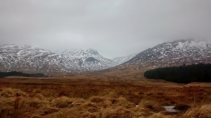
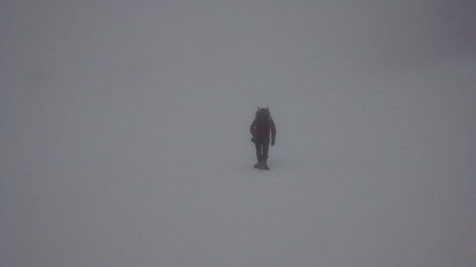
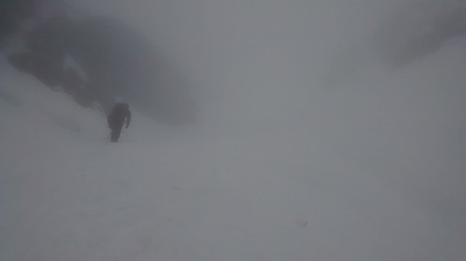
Last weekend I made my first attempt at packrafting, taking a cheap and cheerful trip down Ullswater in the Lake District. I found the trip more difficult than expected, partly because of the weather and partly because it was a new adventure and I only 1/2 knew what I was doing! here are a few things I learned for next time.

  1. Spraydecks are useful – Like on a kayak spraydecks are covers that seal between your waist and the raft and prevent splashes and drips getting into the craft. Being in a £30 dinghy rather than a proper raft I did not have one and had to stop every hour or so to bail the inch or so of accumulated water out the boat.
  2. Gloves are good – Your hands will get wet from the paddles; I ended up with small blisters on both hand from the rubbing of wet skin, a pair of neoprene type gloves will not only prevent this but keep your hands warm too!
  3. Footwear is better- I paddled with a pair of approach shoes for the walking section stored self in a dry bag but did not think to bring anything to paddle in. Que. cold wet feet, and sharp pointy rocks. I had a pair of kayaking shoes at home and wished I had brought them
  4. Balance your boat- Spend some time setting up your raft get everything in balance and a comfortable sitting position paddling around the launch point before you set off, don’t get over excited to be away and then have to try and do this later when you get pins and needles in the middle of the lake.
  5. Protect your air valves – If like me you start with a basic dinghy the inflation valves may be simple and in a position where they can be easily knocked. I managed to accidentally dislodge the valve for the floor chamber shifting my rucksack in the boat. Fortunately this was the least crucial of the chambers and I was easily able to reach shore and re-inflate. At the end of the day removing my bag from the raft the inner ring chamber accidentally deflated, that would not have not have been good mid-lake. I can’t speck for the valves on expensive rafts but in future I will cover mine after inflation with some gaff tape to protect them from movement in the boat.
  6. Trying to film in a raft is a right faf – No solution yet, it just is!
  7. If its windy take the kayak – Although this limits the whole walking bit.

Alastair Humphreys has some further tips, I should have paid more attention when I read this the fist time.

I should also add.

  1. Its great fun
  2. A post paddle swim is mandatory!
  3. Research your rivers beforehand if possible, UKriversguidebook is good for this
  4. You need a buoyancy aid, yes you do.

A First Packrafting Trip

“Believe me, my young friend, there is nothing – absolutely nothing – half so much worth doing as simply messing about in boats.” These words from Rat to Mole in the Wind in the Willows, invoke the joys, beauty and adventure of days on the water, invoking motifs and memories, the gentle rocking of the boat, sunlight glinting off the water, or the long branches of the weeping willow swaying lazily in the breeze.

The Edwardian idle of Ratty and Mole lounging on a riverbank may never have existed even when the words were set to paper; indeed as my packraft lurches over yet another wave the Wind in the Willow-esque dream I had imagined for todays tip on water could not be much further from the reality.

So why did I find myself in the middle of a boisterous Ullswater lake in what, wishful thinking on my part would describe as a packraft, but in reality could be more accurately described as a dinghy!

So to rewind, the idea for this trip had grown out of various ideas to have an adventure that allowed me to see the Lake District from a new angle, away from the crowds, and also with a real feeling of pushing myself to try something new. So with maps spread out on the floor at home my finger trying to trace rivers, lakes, and tracks I came up with the plan; a traverse north to south down the length of Ullswater and Windermere with a wild camp on the hills hiking in between the two sections of paddling. I had visions of lazy summers days on the lakes, exploring the islands which dot their surface, a proper adventure.

I’ve owned a kayak for many years, but its a big lump of plastic that is the antithesis of the words light and flexible, I really struggled to see how I could use it in a practical way, and certainly did not want to carry it over any hills! Fortunately new outdoor toys are appearing to fill problematic niches such as this, what I needed was a packraft.

Small inflatable boats, packrafts are a long way from kayaks; virtually the only similarity they share is they work on water and you move them about with a paddle. The first packfrafts originated to help troops cross rivers in the mid 20th century, but the boats we know today really came out of Alsaka much more recently. Developed to help people move through the mountain and dense forest that makes up much of the state; they are light enough to be carried in a rucksack but durable and sturdy enough to run the white water.

It seemed the perfect solution, supreme flexibility of movement, easily capable of taking a person, sack, and even a bike over river and lake, quickly linking together points on a map that would otherwise be a challenge. For Scotland, Scandenavia, indeed anyplace that is a land rich in water they look great, I knew I wanted one, and then I saw the price and knew I had a problem!

Lakes (2 of 2)

A Still Looking Ullswater at Dawn

So this is why I’m currently paddling along the length of Ullswater in a £30 dinghy rather than a £1,000 packraft; as this first trip is on flat water and I’ve convinced myself I’ve no need for a white water capable craft, which is good as currently neither does my bank balance.

The weather dealt the first blow to my well laid plans, the forecast was for a dry still weekend but unfortunately the high pressure system bringing these benign conditions must have been delayed, because when I launched from Pooley Bridge on Saturday I found myself paddling into a headwind strong enough to cause the yachts on the lake to slew round their moorings, their flags and pennants streaming out in the breeze.

I had chosen to paddle within 30 or so meters of the bank just in case I had an issue with the raft and needed to beach it quickly! I lashed my rucksack to the grab-line round the craft to prevent any accidental offerings to the lake and further stuffed it with two inflated airbags  taken from my kayak just in case.

In the teeth of the wind any forward movement was heavy work and progress felt hard won, staring at the bank I would watch as I ever so slowly caught and overhauled trees and rocks, after about two hours I pulled into the bank for a rest and made the dispiriting discovery I had covered only about two kilometres.

Ullswater looks very different on the lake itself, from the banks you only see one aspect, a neat perspective of the water and shore leading the eye out into the lake. From high in the the hills you get a different view, how the lake fits in the landscape, the curve of the bays, and bumps and spurs of promontories or dog legs. From the middle of the lake the biggest feeling from the landscape is a sence of space, stretching out in all directions, distances become hard to judge as promontories overlap with each other foreshortening perspectives. The shape of the lake is also hidden, bays and even the large dog leg half way down the lake only revealing themselves at the last moment sliding into view from behind hills and trees.

IMG_7120

£30 of High Performance Packraft

At about the half way point I had to be bold, to reach my campsite I needed to cross the lake, moving out from the safety of the shore over about 600m of open water which at my current pace could take me at least three quarters of an hour. In still air this would have been fine, but the windy conditions had whipped the waters out from shore in to a decent swell which the though of battling far from the safety of the bank I found unsettling.

With my pulse slightly raised I concentrated on paddling efficiently with good strokes on both sides to make progress as quick as possible, attention focused on a rocky buttress on the far side of the lake. Once out of the protection of the shore the wind seamed to pick up and the waves increase, I had to take them head on but the raft coped better than I had expected although I did ship a bit of water from splashes that required bailing out (proper packrafts come with spraydecks). When I reached the far side I landed on a tiny beach for an obligatory large mug of Yorkshire Tea and biscuits feeling particularly heroic!

After six hours of hard work and having covered a mere 10km I arrived on the small beach at Silver Bay, I had spotted the location earlier in the year and marked it out as an excellent camping spot, a thin strip of grass lying between the gravel and thick bracken. The paddling had been so hard but also very rewarding, I felt I had made a real effort to make those 10K and managed to deal with what the weather had thrown at me. I did however realise I had bitten off more than I could chew for a first trip and I had made the decision paddling Windermere tomorrow was not on the cards .

By the time the tent was up (and more tea brewed!) the wind had begun to drop, leaving just a few ripples on the surface of the lake and a beautifully still evening as the last few boats headed in to their morings for the night. Although Ullswater is a busy lake Silver Bay feels secluded and I was able to go for a cheeky, if also slightly chilly wild swim au-naturel without the fear of being overlooked.

Camping

Camping at Silver Bay

Settled conditions had certainly arrived by Sunday as I took the tent down in the still morning air. Raft deflated and packed, buoyancy aid stowed, and paddle disassembled it was time to validate the first half of the packraft concept. Proper rafts weigh about 2.2kg, obviously for £30 mine weighed about half as much again but my pack was not uncomfortably heavy and certainly manageable for multi-day trips.

My walking route took me up Heart Fell by the Hartsop ridge, the original plan, now discarded in favour of a more sane option had been to descend from here to Ambleside and paddle the length of Windermere. Instead I now followed the ridge line round to Red Screes before descending down to the Kirkstone pass and a well deserved beer before catching the bus back to Pooley Bridge.

I will certainly return to packrafting although probably in something a little more rugged next time. There is a lot of possibility for real adventures, new approaches to the hills such as Slioch across Loch Maree, or the Munros down Loch Etive in Scotland; even in busy England its a great way to explore the Lakes, the Broads, or the Thames; for those with white water skills they offer even more flexibility. Just being on the water makes any trip to the hills a little bit more adventurous, because deep down we all think a little bit like the Mole.

“Never in his life had he seen a river before—this sleek, sinuous, full-bodied animal, chasing and chuckling, gripping things with a gurgle and leaving them with a laugh, to fling itself on fresh playmates that shook themselves free, and were caught and held again. All was a-shake and a-shiver—glints and gleams and sparkles, rustle and swirl, chatter and bubble. The Mole was bewitched, entranced, fascinated.”

Heartsop

Looking Down Hartsop on How from Heart Fell