An earlier draft of this blog was published on my old site on 21st September 2014.
Mountain High has a lot to answer for, a weighty coffee table tomb whoes smooth glossy pages are crammed with crisp pictures of endless switchbacks rising up a mountainside, pictures that put ideas in your head that are hard to shake. The book, which we had come to refer to as the bible had been a mainstay of our evening entertainment, camped in warm evening sunlight with a glass of red wine, as we read in sumptuous detail the history of these famous roads, glorying in the hard won challenges of today and dreaming of those kilometres to be won tomorrow.
Hidden away in its pages was Gavarine a stunning cirque of mountains and one of Frances finest national parks. From the town of Luz-Saint-Sauveur a beautiful road winds its way into the park and up to the Spanish border. At 30km and a whopping 1500m of climbing it would be the biggest test ever on my bike.
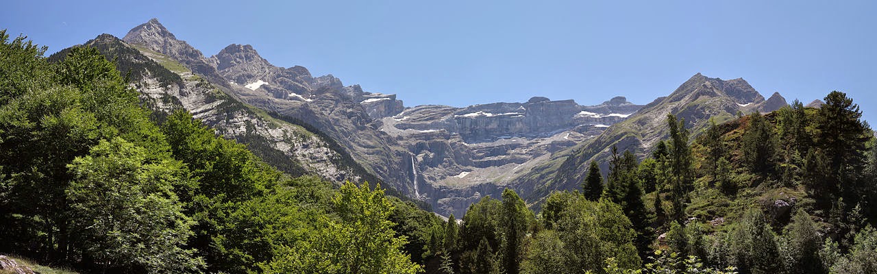
Cirque du Gavarine (photo by Eusebius (Guillaume Piolle)
The big problem was in the way between our campsite and the start of the climb was the Col du Tormalet, and the thought of driving over arguably the most famous mountain pass in cycling bordered on the sacreligious. The downside of this though is that the Tormalet itself is 1200m high and 20km long and the thought of tagging this onto the start and then obviously the end of the day was a bit much!
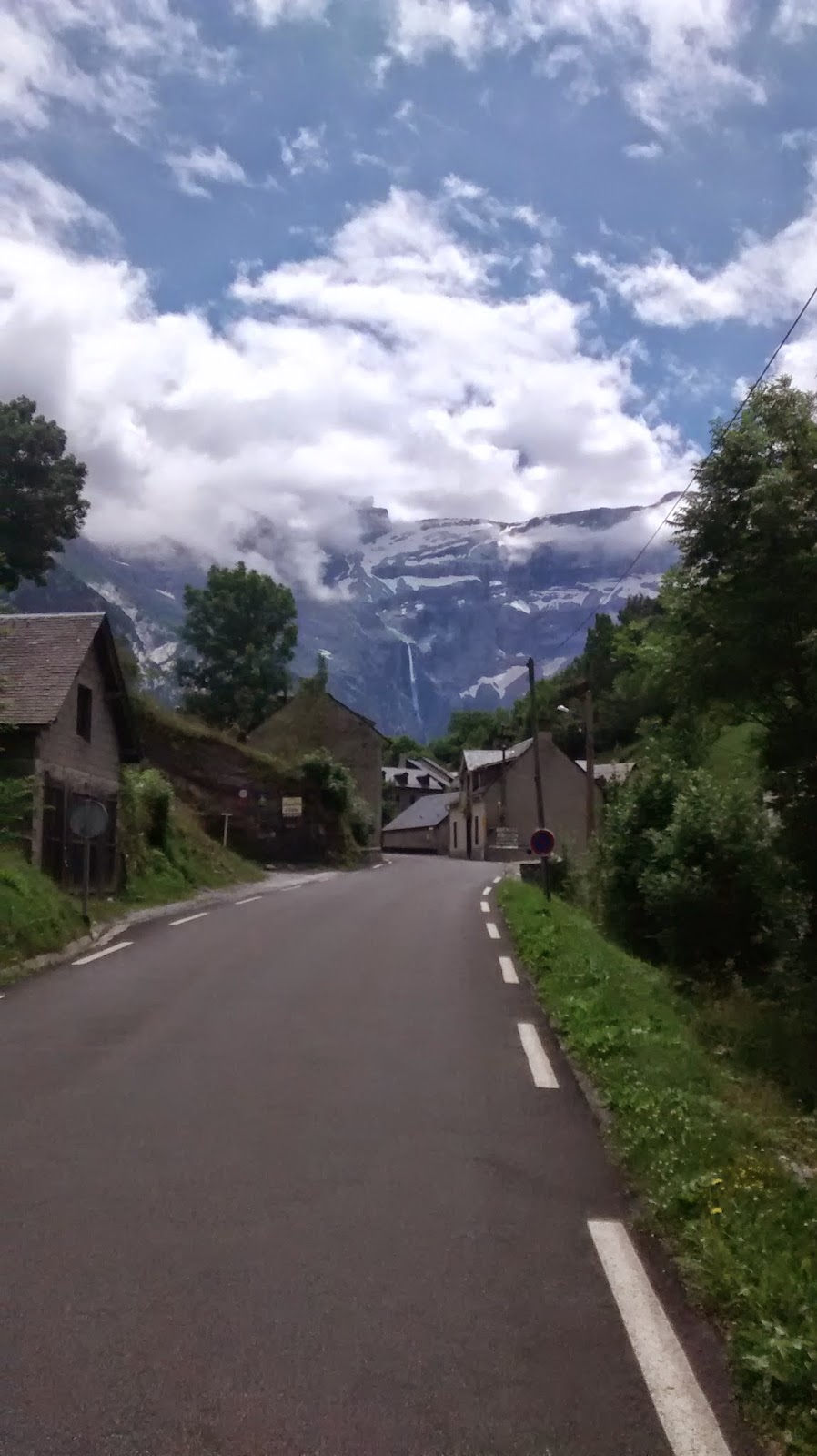
Rather than follow Rule 5 and climb the Tourmalet twice we drove to La Mogine a small ski resort perched on a grassy alp about 4km short of the col on its eastern side. The resort is one of the myriad of less than picturesque examples that little the mountains here whose architecture can be described as somewhere between abysmal and appaling.
The Tour had been over only a few days before so the road was covered with graffiti encouraging the riders with messages of support ranging from inspiring to downright bizarre. This made the short hop to the summit and interesting one although quite how a line of giant sperm swimming their way up the tarmac to the summit was supposed to motivate the riders I’m not quite sure.
The decent of the top was fun, following a sinuous line of asphalt draped down the mountain, cars were overtaken, corners carved on the racing line with a flourish. Towards the bottom the road follows the young river which cascades down the slopes, and at the same time it straightens and widens into a long trail of brand new tarmac; here my speed must have hit an exhilarating if scary 80kph although I struggled to keep up with Josie who was flying.
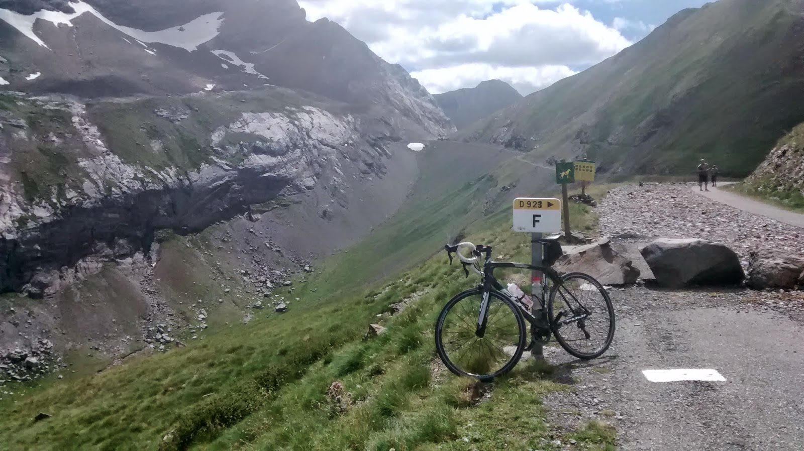
The Gavavine climb was suitably epic, gentle for the first 10km or so as it follows a steep sided ravine. As you approach the Cirque the road steepens but does not really kick in till just after half way, when you leave Gavarine village and begin the climb to the border. Here you also leave the tourist hotspots behind and consequently the road surface deteriorates with cracks and loose gravel as it cuts its way upwards at between 8 and 9% for the next 12km or so.
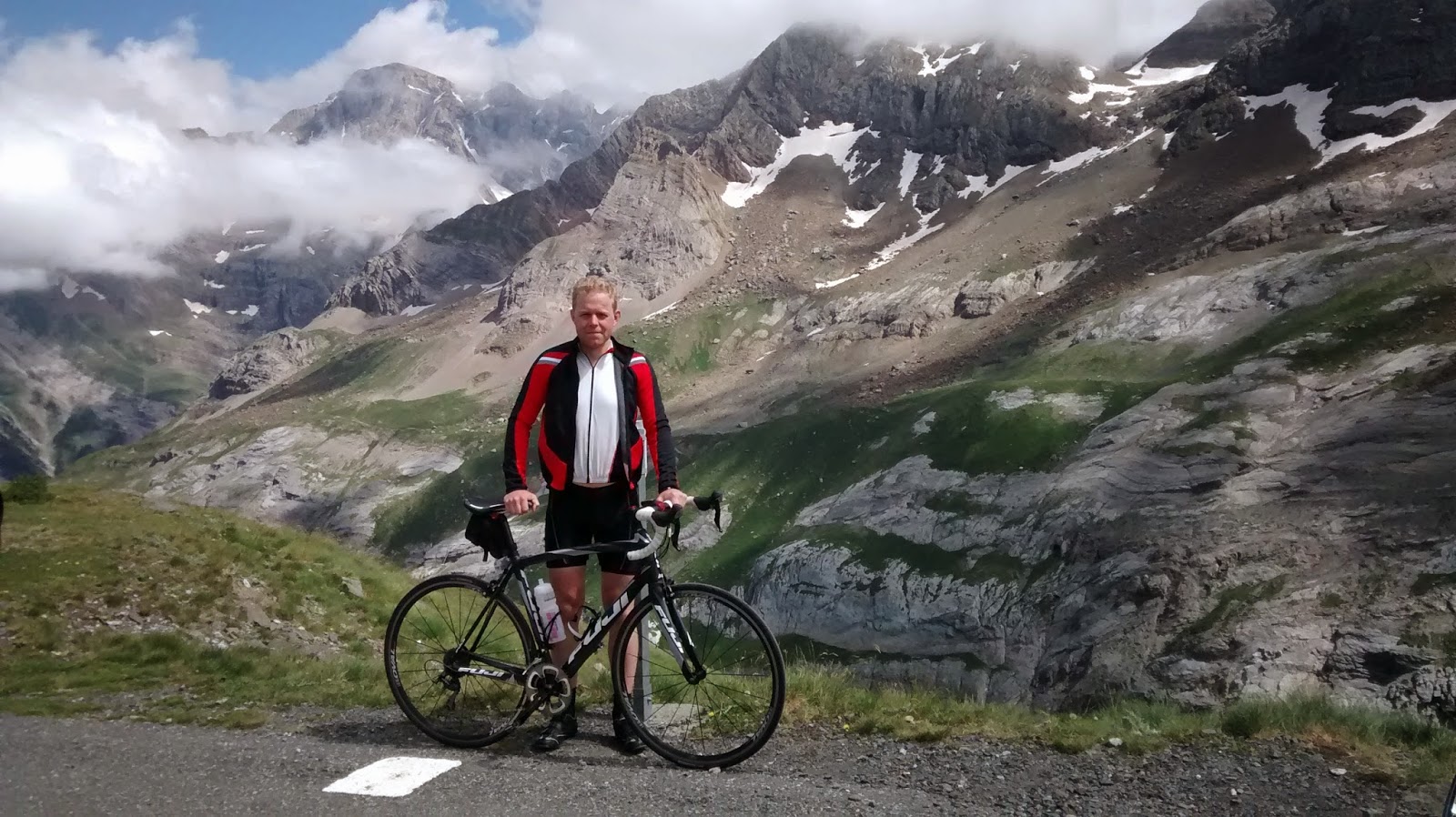
The effort is worth it the road runs out at a small car park as a track winds off to the border, the view is spectacular with peaks towering above and grate slabs or rock on show from a relatively recently retreated glacier. Not for the first time on this trip I regret the fact that road cycling and photography don’t really mix as I would love to have had my SLR with me. Then its time to enjoy the fruits of the climbing effort and turn to a decent which was gripping even if in places the road wasn’t!


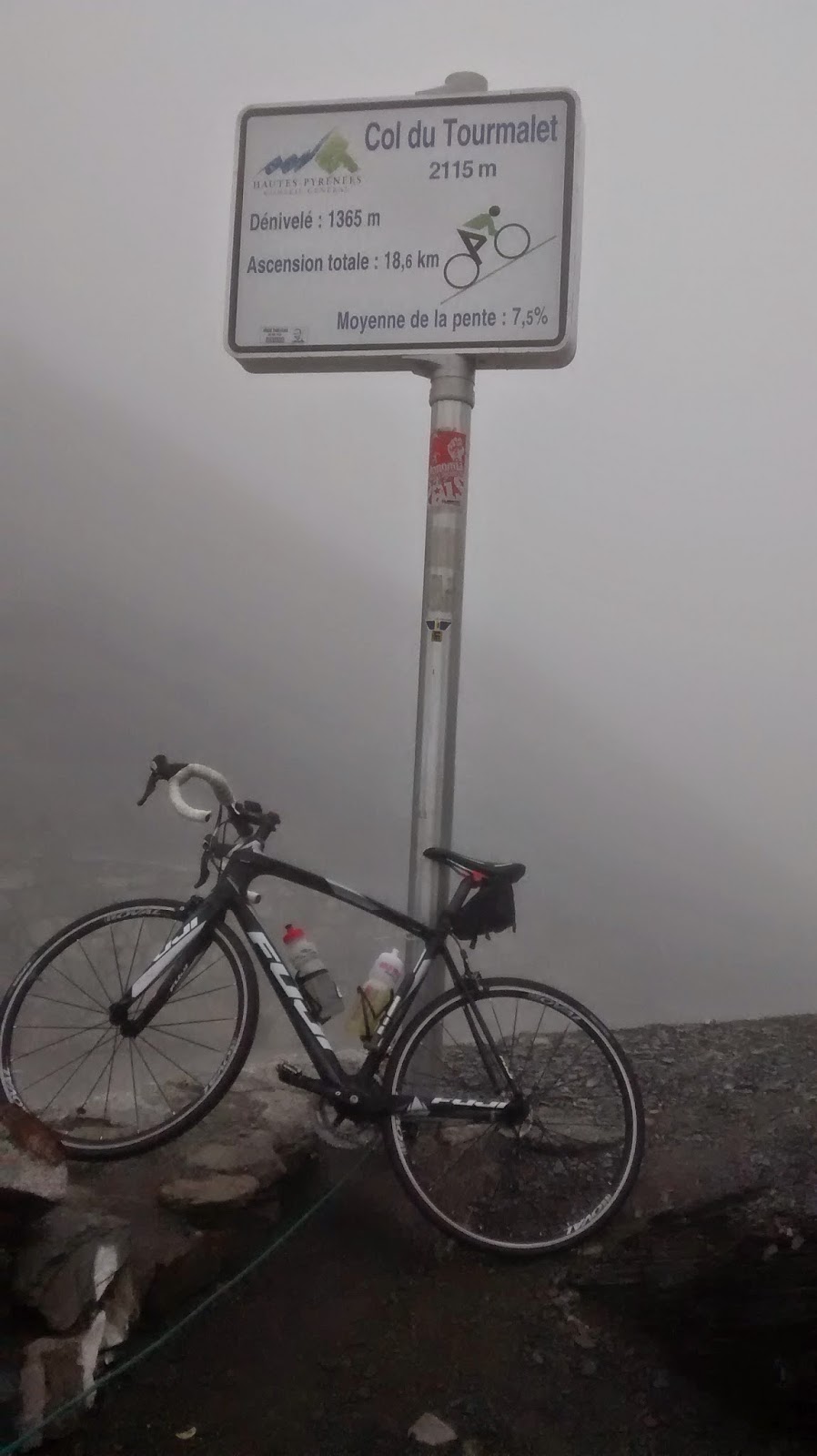
Back in Luz-Saint-Sauveur and with 80 plus kilometres in the legs I will admit that despite its uber classic status I was not 100% thrilled at the thought of taking on the Tourmalet. From the west the climb stits at a gradient of practically 8% for its entire length so it was just a case of getting into a comfortable gear and plodding upwards at a good cadence. I had the added motivation that my garmin was close to dead as I was running Strava and I wanted to get to the top and claim the segment for posterity (unfortunately it died a few km short of the summit).
As the climb went on the weather deteriorated, mist and cloud enveloping the hills although fortunately the rain held off. I had spent the last hour and a half with my short sleeve jersey open, the effort of the climb keeping me toasty and thought I was prepared for the vicious temperature gradients cyclists can sometime experience going over a big hill. I was not… By now the summit was a dreary place, visibility was about 20m with a bitter wind cutting across the ridge. Despite quickly changing into long leggings, a winter smock and windproof I was soon shivering as a tried to hold my phone still long enough to take the obligatory summit photo.
The decent may only have been 4km but was deeply deeply unpleasant; the cloud blocked out all visibility apart from a short stretch of slimy saturated tarmac and which ended in a steep grey void into nothingness at the edge of the road. As I crawled down road into the drizzle my body attempted to shiver itself off the bike as I tried to balance the risk of going too fast on the slippy surface with the desire to be in a warm car as soon as possible.
La Mongie did not appear until I was practically on top of it with some monstrosity of concrete looming out the mist. Just before the car the ride threw in one last curve ball with a flock of goats strewn across the road perfectly camoflaged in the mist, a mad end to an epic day.

