The Black Mount

Updated from my old blog just to get everyone in the mood for winter…

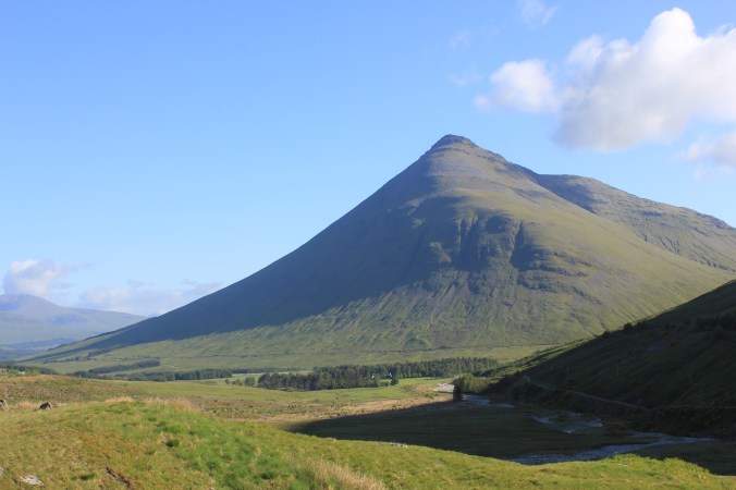
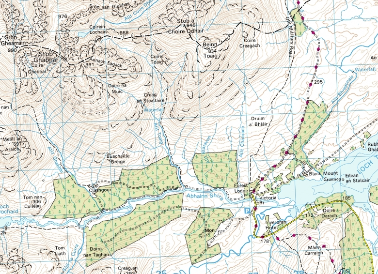
Stob Ghabhar and Stob a Choire Odhair are two Munros that form part of the Black Mount west of Rannoach Moor and overlooking Loch Tulla. Climbing Stob Ghabar in winter is made a little bit more interesting two easy snow couloirs imaginatively (in what must have been a burst of creativity) given the titles “upper” and “lower” with give access to the summit from the north.

The Lower Couloir leaves from just above a small lochain perched high up at the head of the Allt Cchoire Dhearbhadh itself a long slog across the high plateau west of the West Highland Way as it crosses Rannoach Moor.

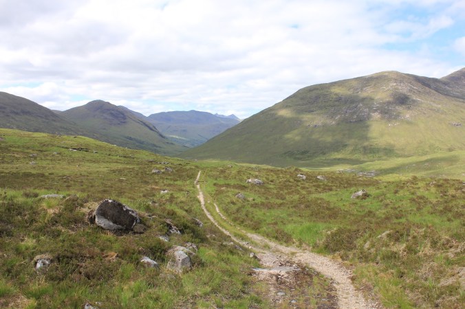
Looking for some climbing on a dull overcast day Dom and I decided to approach from the south parking near Inveroran and walking up the old stalkers track that runs up into to Corie Toaig and the col at 668m between the two Munros. From here it looked like a short traverse round to the lochain and the climbing.

img_20150211_090929457

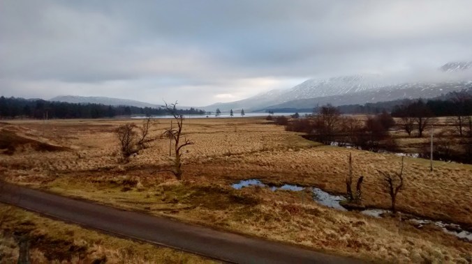
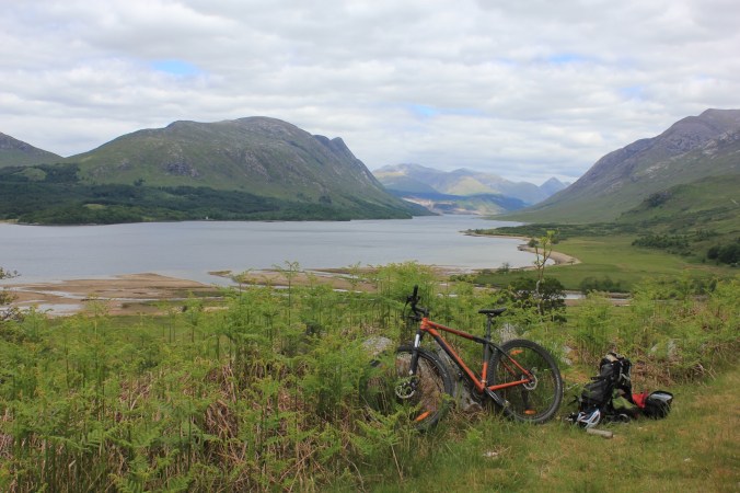
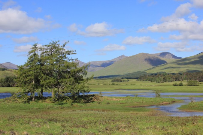
Overcast sky above Loch Tulla

IMG_7177

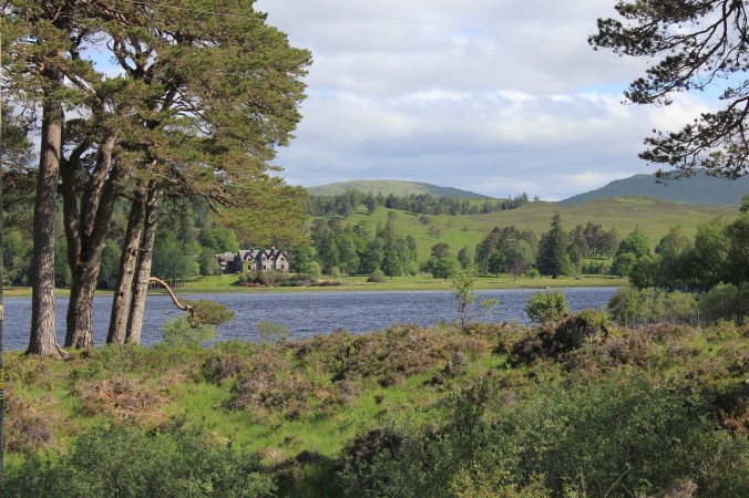
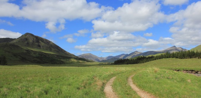
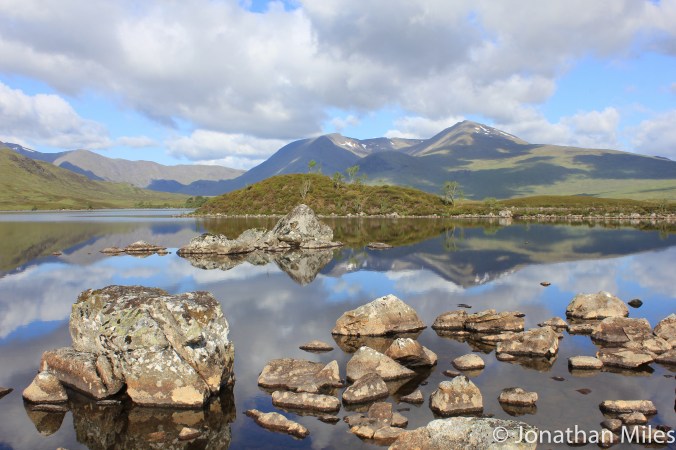
Loch Tulla in slightly better Weather
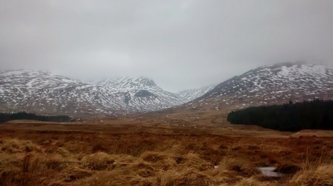
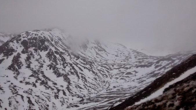
img_20150211_151804278

Corie Toaig


IMG_7176

I think this is the same peak in slightly better weather?


A good track leads most of the way to the col, crossing the snow line at about 500m we are soon enveloped in thick fog which obliterates the horizon and leaves us struggling for reference points as snow and sky blur in to one and classic Scottish white out conditions. The disorientation especially on relatively open ground makes route finding difficult and both Dom and I have to work hard to make sure we hit the col at the right point as I display an alarming tendency to let the terrain pull me too far to the east.

From the col there is no chance of catching sight of the lochain and we are faced with a mass of white cloud into which we descend on a baring taken off the map; pacing out the distance we take great care, conscious of the fact that the lochain is probably frozen with a covering of snow – not a good place to blunder out on to!  Finally in the matt light which surrounds us the eyes catch sight of a hint of blue snow to our right giving away the position of the water, barley noticeable in the fog.
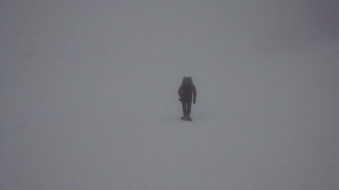
img_20150211_113311148

Where are we?


img_20150211_114823709

Really, where are we???


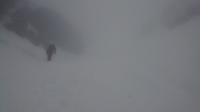
However finding the lochain was only the start of the difficulties, with viability so poor there is no sign of the couloir or even any real rock bands above us, leaving us with little indication of where to go. The 1:25:000 OS map indicates a spur of rock running down to the edge of the water which forms the right hand edge of the run out fan leading up into the funnel of the Lower Couloir. Contouring a safe distance from the edge of the water we traverse round until this band of rock emerges from the mist then turn left and begin to climb steeply. The couloir is wide and its only after a couple of hundred meters that it narrows to the extent we can see both walls giving us the confidence we are on the right track. The terrain is steep of grade 1 but we have finally come across a line of foot prints for us to follow making the work easier and helping convince us we are on the right track.

The gully finishes on a steep upper snow field, continuing straight up would eventually lead to the summit but to reach the Upper Couloir we must traverse left over steep terrain which were it not for the zero visibility would feel very exposed. The architecture of the mountain is very difficult to piece together in this weather but our route is clear from this photo on UKC showing the narrow gully cutting a crescent shape through the summit buttress. 

The gully itself is excellent, narrow and well packed with good ice, a grade harder than the Lower Couloir with a step of grade II where I wished the rope was not snug and secure in my rucksack as I climbed it. I captured the short brown trouser moment for posterity below.


The gully finished pretty much on the summit which was being lashed by a bitterly cold wind and not the place to linger especially without any view to distract the attention and the camera. We quickly dropped down the ridgeline to the col grabbed a bite to eat and then traversed on to Stob a Choire Odhair which felt hard on the legs which had already put themselves through a significant amount of accent. On the top I was forced to deploy the emergency Harribo for a sugar filled decent back down to the van.

img_20150211_142840295

Stob Ghabhar from Stob a Choire Odhair

black-mount-1-of-1

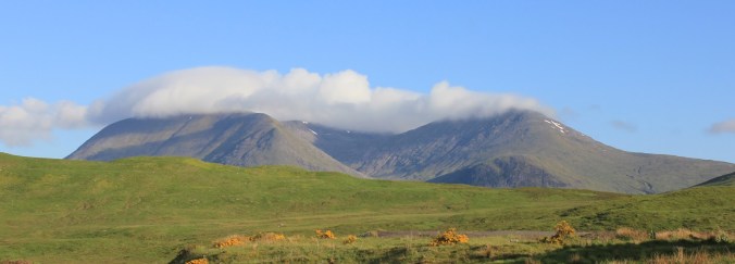
The Black Mount in slightly better weather

Advertisement

Tyndrum to Taynult; The Back Way

Migrated from my old site this was originally published in June 2012

With Scotland basking under a high pressure system bringing glorious blue sky’s and little wind the obvious thing to do was to go for a big ride, linking togeather the netwoork of tracks and trails that wind through the valleys and cross the passes. Starting from Tyndrum the route initially follows the West Highland Way before heading towards the western end of Loch Tulla. Here tarmac is dispensed with entirely and the route runs the entire length of Glen Kinglass before emerging into Glen Etive and then back to civilisation. 

A ride that clocks in at almost 60km (even if the guidebook claims the contrary) and leaves you miles from your starting point may not seam too good an idea. Here however is the master stroke, both start and finish are served by stations on the railway line to Oban; time it right and you’ll be back  for tea and hero biscuits in no time, get it wrong…well don’t get it wrong!

IMG_7230

Ben Dorian


IMG_7176

Stob Ghabar from the road to Inveroran

The initial section on the West Highland Way is mostly on a good track apart from one short section of poor single track that is possibly just about rideable if your brave. An initial climb leaves you at the head of Glen Orchy with great view down toward Ben Dorain a giant cone of a hill that dominates the first few kilometres of the ride until you finally contour round it’s flanks and drop down towards Bridge of Orchy Station.

Crossing over the A82 and following the minor road to Inveroran the last bit of tarmac the tyres will see for a while when it ends at the head of Loch Tulla. Running through a section of Caladonian Pine forest, trees twisted into fantastic shapes a contrast of greens and browns the route is ridiculously picturesque in the bright sun. Mercifully there is just enough of a cool breeze to keep the midges at bay and bring the fresh smell of the forest.  

IMG_7177

Loch Tulla


IMG_7170

Beinn Achaladair and Beinn Dothaidh


As the track begins to climb it slowly starts to deteriorate from broad hard packed gravel road as far as the remote farm at Clashgour to two thin wheel lines weaving and climbing steeply through the grass. The view both up the valley and back down towards the Bridge of Orchy Munros is superb, with a panorama of mountains stretching away into the distance and towering over the glen.

A line of stepping stones cross the River Shira, (bridge available slightly further unstream if the levels are slightly high) and mark the start of the wildest park of the ride. A few kilometers of good climbing reaches Loch Dochard and with huge views into the vast rounded coires of Glas Bheinn Mhor, and Stob Chir’an Albannaich the Glen Etive Munros here viewed from their hidden and less well trodden side.

IMG_7186

Looking up Glen Kinglass


IMG_7185


From here the trail is little more than a thin sliver of single track dropping down into the valley which opens out in front. Occasionally great rounded slabs of granite bedrock outcrop at the surface like vast boiler plates; their gentle angle and sooth grippy surface a joy to ride.

The route follows the infant river Kinglass here  a succession of waterfalls and short canyons as it makes it’s way down the steep valley. A line of inviting plunge pools break the rivers flow and one of these offer a cool, ok cold but refreshing dip at lunchtime. Lower down the track improves before becoming a proper gravel road at Glen Kinglass Lodge then following the river for at least ten kilometres to the foot of the glen

IMG_7198

and onwards….


The River Kinglass flows into Loch Etive mid way down it’s length; the loch itself is a thin sliver of sea that cuts far inland, its narrow upper reaches overlooked by some of the finest hills in the highlands. Looking back up the loch the peak of Ben Strav dominates the foreground and in the distance the fine cone of Stob Dubh marks the head of the loch.

The track now winds its way round the edge of the loch clinging to the hillside and delivering a lot of short sharp shocks to the legs with some surprisingly steep climbs. Having now covered about forty K the gradient feels hard, each climb requiring a real effort and inevitably turns out to be never the last one. Ben Cruachan looms ahead and must offer a fantastic view the entite length of Loch Etive.

IMG_7216

Looking up Glen Etive


This final section lasts much longer than expected and despite the good surface is the hardest section of the ride the steep climbs draining down on tired legs. Then suddenly its back to tarmac and cars for a short section on the A83. 

Arriving in Taynult a bit early for the train I settle down for a coffee and cake and watch sea kayaks out on the loch. Todays ride really was one of the most fantastic I have ever done, never particularly hard but with a great remote feel and sense of journey you only really get when you do a one way trip. As the train rattles up towards Tyndrum there can be few better ways than to spend a day than this.

From the Sea to the Land Beyond – A Cycling Odyssey on Coll, Tiree, and Barra

If you block out the cold it could almost be the Mediterranean, the beach an expanse of golden white sand gently lapped by a turquoise blue sea, fading gradually to deep blue moving out into the ocean. My nerves are however, telling me that whatever images my eyes may be sending to my brain they beg to differ with the conclusion that I’m swimming in a gentle bay somewhere in the Agean Sea; the water is numbingly cold and I can only stomach a few minutes immersion before I have to drag myself to the beach to warm up in the warmth of the sun.

The beach I’m swimming off, known as North Bay is, logically enough located on the northern tip of Coll one of the Inner Hebrides, small specks of land off the coast of Scotland between the mainland and the island chain of the Western Isles.

Western Isles (1 of 5)

North Bay on Coll

Coll is a small island only about 20km long by 5km wide and I had spent the morning exploring its roads, tracks, and beaches on my bike before stopping for lunch and a brief swim in the sea. Coll and its neighbour Tiree are an ideal pair of islands to explore by bikepacking, and I had chosen them for my first trip with my new off road BOB trailer. The ferry operator Caledonian MacBrayne which serves the islands from Oban on the mainland don’t charge extra for bikes making tickets excellent value.

Coll and Tiree are very contrasting neighbours, Coll is much more rugged with an interior of peat bog and lochans, the coastline is jagged particularly the eastern coast where the sea breaks itself over rocky outcrops of Lewisian Gneiss which at 2.5-3 billion years old are some of the oldest rocks on Earth and a window into deep time.

Tiree in contrast is much lower lying than Coll and, with the exception of three small hills is very flat giving a big sky feel to the landscape which is covered in fertile grasslands covered in wild flowers. The beaches are huge and open with the sea rolling in over the white sands giving apparently world class surfing and kiteboarding conditions.

Western Isles (6 of 2)

Tiree Grasslands

Western Isles (7 of 2)

Kitesurfers off Tiree

On most days I managed to wild camping amongst the dunes behind the beachs hiding the tent away amongst the peaks and troughs of sand and enjoying a feeling of remoteness at the sunset over the sea. One particular sunset on Tiree was astonishingly spectacular the clouds in the sky luminous pinks and golds as the sun faded from view.

In the morning dregs of sleep were expunged with a refreshing dip in the sea to get the blood running. On all the beaches I explored I found the sand to be generally well packed, even enough to pull the laden trailer on. The gradient shallow was also shallow giving quite a large tidal range between high and low water levels.

By backpacking I could easily strike the tent in the morning and tow all my kit with me as I explored the islands by bike, roads, tracks, and paths were gentle enough to cycle easily even pulling my kit with me. Although not as bad as the mainland the midges were still out if the wind dropped but normally there was enough of a sea breeze to keep them at bay.

Western Isles (3 of 5)

Traig Feall Beach on Coll

Once a week (Wednesday) a ferry runs from Coll and Tiree out to Barra in the Western Isles; an makes an excellent extension to the tour as the Barra ferry returns to Oban giving a nice circular route, and having missed Barra on my previous visit to the Western Isles I made use of this to add a few days to the trip.

The ferry crossings especially to and from Barra were for me almost a romantic experience, a glimpse of time gone before air travel when it took a week to cross the Atlantic and five weeks to get to Australia and the journey itself was an adventure.  The distance to Barra takes the ship out of sight of land and leaves you standing on deck surrounded by the expanse of the sea as the ship ploughs on under the giant dome of the sky making progress but never seaming to move.

Western Isles (4 of 5)

A beach on Tiree

Barra is much larger than Coll and Tiree and more heavily populated although the roads are still very quite. A good ride to explore the island is to cycle round the road which circles  the hill of Heaval which dominated the centre of the island. Diversions from this can be made south to explore the island of Vatersay which is connected to Barra by a causeway and has yet more astonishingly beautiful beaches; or to the north to see the bay of Traigh Mohr and if you time it right a truly unique experience.

Barra has a problem in that there is not enough flat land for an airport, at low tide the sea retreats from Traigh Mohr to give a vast expanse of flat sand and the worlds only beach airport with scheduled flights. Watching an aircraft land in a mass of spray is a spectacular sight.

Barra (1 of 1)

Leaving Barra

Logistics

Wild camping is allowed in line with Scottish access laws, this means walkers and cyclists not camping from cars.

Coll – There is a campsite at Garden House towards the south of the island and a bunkhouse in the main village of Aringour. The village also has a small shop although opening hours are short. There are free toilets and paid showers available 24 hr at the community centre.

Tiree – To my knowledge there is one campsite on the island. Camper vans, motor homes , and car campers must use this or one of 11 designated crofting camping areas which must be booked and paid for on arrival. This is to protect the vulnerable grasslands which took a pounding before the system was introduced. There is a well stocked Coop just up from the Ferry Terminal

Barra – Campsite at Bove just north of Castlebay and also in the north of the island, Coop in Castlebay.

Western Isles (5 of 5)

Arnamurchan Lighthouse, the westernmost point of mainland UK

Harris and Lewis

The Western Isles had attracted me for many years, drawn by wild landscapes, beautiful golden beaches and azure seas usually seen at latitudes much further south than they are. Like the far north west of the mainland they are a bit of a mission to get to from the north of England. I’m looking forward to the day hopefully not too far away if current research progress continues when cars can dive themselves, imagine going to sleep Friday evening in a camper van and waking up with it having driven you 300miles away! The extra freedom this will offer will be amazing.

Anyway I visited last year taking the ferry over for a few days cycling and exploring. I had a couple of locations I wanted to visit from a photography point of view, there are some spectacular images taken from the beaches on the western cost of Harris taken by others and I had hoped to capture something similar.

In the end none of my images particularly excited my as any of my best, I great sunset shot was always just out of reach particularly due to the not insignificant oversight of forgetting to take my camera stand and thus being somewhat limited in the exposures I could take.

Western Isles (1 of 5)

The Lighthouse at the Butt of Lewis looks out over the North Atlantic. The image is a 3 shot HDR composite

Western Isles (2 of 5)

Another view of the Butt of Lewis Lighthouse

Western Isles (3 of 5)

A beautiful beach at Port of Ness, a village on the north cost of Lewis is typical of the golden sand and light blue seas of the north west. It was actually raining quite heavily and difficult to keep the lens dry.

Western Isles (4 of 5)

Lewis is rich in prehistoric monuments from a long history of habitation. These stones are park of one of the smaller circles at Callanish and would photograph really well at sunset. Again this image is an HDR composite. 

Western Isles (5 of 5)

The beach at Horgabost campsite has stunning view across to the hills of North Harris

Beinn Mheadhoin and Loch Avon

First published on my Blogspot site 15th October 2015

The first few days of my trip north had been characterised by low cloud and drizzle, the weather suggested little prospect of a good day on the hills with the peaks of Cairngorms lost in a blanket of grey cloud smothering out the sun. Having brought my bike with me I had passed the time with a good ride through the woods of Rothiemurchus and and run between Loch Ericht and Loch Laggan via the remote Loch Pattack the bike making short work of the landcover tracks now carved deep into the hills.

Today was different a glimmer of hope to my drenched expectations as I was fast running out of dry cycling kit. The forecast was for a high pressure system to settle over the northern Cairngorms giving blue skies and an excellent opportunity for a long walk into one of the more remote Munros on my still very long to do list; Beinn Mheadhoin situated south of Loch Avon in the heart of the Cairngorms. 

cropped-cropped-img_97431.jpgA winter view of Beinn Mheadhoin (left) and Carn Etchachan (centre) taken from the top of Coire nan Lochan

A hill I had often seen from afar, its distinctive granite tors is easily visible from the top of the Northern Corries after a days climbing but from any further approach it is well guarded from casual suitors by the deep trough containing Loch Avon which to my knowledge must have a good claim as being the most remote large body of water in the UK.

The air was cold and crisp as I left the ski centre carpark but as the sun continued to rise its rays soon provided a warming glow as a worked my way through the clutter of ski detritus that is Coire Cas in summer as various bits of heavy plant dig and scrape their way about the hill in preparation for the coming season. Snow cannons sit forlornly beside a maze of picket fences and lift cables look incongruous agains the heather.

Looking down the gentle slopes of Coire Raibeirt towards Beinn Mheadhoin its tors clearly visible against the skyline.

Having joined the path up to imaginatively named point 1141 which is perched on the shoulder of Cairn Gorm I follow a faint path across the plateau which drops down the gentle slopes of Coire Raibeirt picking up a small stream of tumbling water as it goes. Beinn Mheadhoin dominates the view whilst Loch Avon itself remains hidden in a deep trough ahead only becoming visible at the last minute as the path drops very steeply downwards out of the hanging corie towards the deep blue water. The decent is very steep and strenuous efforts have been made to build stairs down for much of the route saving what would be a pretty horrific scramble over loose rock although the path does eventually end up in the stream bed, no doubt the decent is a nightmare if coated in verglas in winter!

Towards the bottom I cross the stream and pick up another rough path which leads after much bolder hopping to the head on Loch Avon. The remoteness is palpable, a wild place with steep hills and crags on three sides with just the narrow opening to the north west containing the loch itself. The Feith Buidhe cascades down from high on the slopes of Ben Macdui and is crossed on stepping stones where it enters the Loch.

I make a short detour to visit the famous howff of the Shelter Stone one of hundreds of huge boulders that erosion has prized off the encircling crags which now lies across its neighbours creating a sheltered bivvy cave famous in Cairngorm mountaineering history as the base for many climbers exploring routes on the faces above. The shelter is one of many dotted throughout the bolder field no doubt welcome places to rest for those who brave these parts in the depths of winter, if they can find them in amongst the deep drifts of snow. 

Loch Avon with the slope of Cairn Gorm behind.

 Loch Etchachan

From the head of the loch a path climbs steeply to the col between Carn Etchachan and Beinn Mheadhoin, nestled just beyond this is Loch Etchachan the highest large body of water in the UK at over 900m above sea level; it looks a lovely place to camp in good weather surrounded by such awesome scenery. Just before the outflow of the loch I turn up the hillside to the northwest and climb steeply onto the summit plateau of Beinn Mheadhoin. The landscape is flat and stony with very little vegetation, a testament to the difficult year round conditions plant life faces clinging to life in the poor soil. 

The expanse of the summit is dominated by a series of high granite tors their sides wrinkled like old leather and the largest and highest of which proves to be the summit.  Having scrambled onto the top to me they almost almost justify inclusion alongside the Inn Pin as a Munro needing some climbing skills (but not ropes), certainly there are a couple of moves which would not be out of place on a v. diff

The three summit tors, the highest point being the central tor.

The view from the top is quite spectacular, for 360 degrees hills stretch out around you with no sign of roads, houses or the clutter of modern life, its a place to stop and savour just being in a landscape absorbing it in to enrich your soul before heading for home. I spend about half an hour playing about with my camera taking bracketed exposures to try and compensate for the contrast in light conditions which makes exposing both the brilliant blue sky and green brown earth a really chained even with a couple of graduated filters. Finally having had my fill of the view leaving the summit I retrace my steps back down to Loch Avon as the shadows of the day begin to lengthen.

Naturally having decended steeply this morning its a tough climb back the way I came onto the Cairngorm plateau but the babble of water keeps you company and refreshed. Loch Avon is certainly somewhere I would like to return to, perhaps trying to approach from the west and the Fords of Avon by bike or to explore with a packraft, but those are adventures for another day.

The view from just shy of the summit back to Loch Etchachan and Loch Avon, the count back to Cairn Gorm is the steep gully about a third of the way in from the left.