Scalber Force

With an overcast and rainy week big sweeping landscape vista was out so I visited Scalber Force near Settle. Although very close to the road its a bit of a treacherous approach into a steep gully.

I had intended to take some shots with my big stopper but arrived quite late and due to the setting was able to get 15 second exposures without the need for a filter at all as it was really getting a bit dark.

With a bit of a tweak in Lightroom they have come out better than I expected, slightly too much green but that is mainly given the time if year, I think this will be a good autumn venue.

Scalber (7 of 2)Scalber (8 of 2)

Harris and Lewis

The Western Isles had attracted me for many years, drawn by wild landscapes, beautiful golden beaches and azure seas usually seen at latitudes much further south than they are. Like the far north west of the mainland they are a bit of a mission to get to from the north of England. I’m looking forward to the day hopefully not too far away if current research progress continues when cars can dive themselves, imagine going to sleep Friday evening in a camper van and waking up with it having driven you 300miles away! The extra freedom this will offer will be amazing.

Anyway I visited last year taking the ferry over for a few days cycling and exploring. I had a couple of locations I wanted to visit from a photography point of view, there are some spectacular images taken from the beaches on the western cost of Harris taken by others and I had hoped to capture something similar.

In the end none of my images particularly excited my as any of my best, I great sunset shot was always just out of reach particularly due to the not insignificant oversight of forgetting to take my camera stand and thus being somewhat limited in the exposures I could take.

Western Isles (1 of 5)

The Lighthouse at the Butt of Lewis looks out over the North Atlantic. The image is a 3 shot HDR composite

Western Isles (2 of 5)

Another view of the Butt of Lewis Lighthouse

Western Isles (3 of 5)

A beautiful beach at Port of Ness, a village on the north cost of Lewis is typical of the golden sand and light blue seas of the north west. It was actually raining quite heavily and difficult to keep the lens dry.

Western Isles (4 of 5)

Lewis is rich in prehistoric monuments from a long history of habitation. These stones are park of one of the smaller circles at Callanish and would photograph really well at sunset. Again this image is an HDR composite. 

Western Isles (5 of 5)

The beach at Horgabost campsite has stunning view across to the hills of North Harris

Beinn Mheadhoin and Loch Avon

First published on my Blogspot site 15th October 2015

The first few days of my trip north had been characterised by low cloud and drizzle, the weather suggested little prospect of a good day on the hills with the peaks of Cairngorms lost in a blanket of grey cloud smothering out the sun. Having brought my bike with me I had passed the time with a good ride through the woods of Rothiemurchus and and run between Loch Ericht and Loch Laggan via the remote Loch Pattack the bike making short work of the landcover tracks now carved deep into the hills.

Today was different a glimmer of hope to my drenched expectations as I was fast running out of dry cycling kit. The forecast was for a high pressure system to settle over the northern Cairngorms giving blue skies and an excellent opportunity for a long walk into one of the more remote Munros on my still very long to do list; Beinn Mheadhoin situated south of Loch Avon in the heart of the Cairngorms. 

cropped-cropped-img_97431.jpg
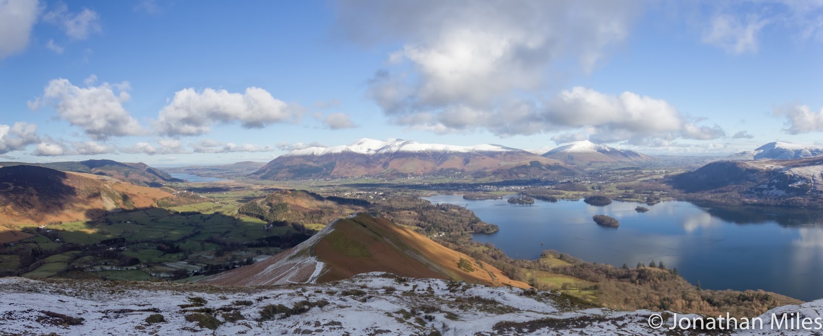
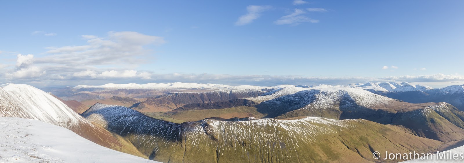
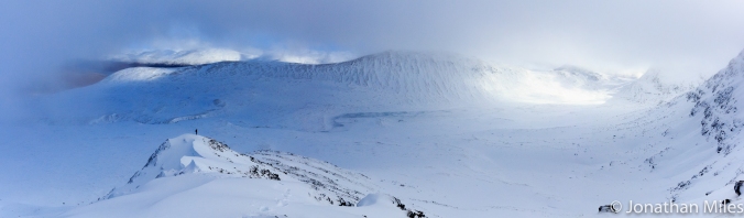
A winter view of Beinn Mheadhoin (left) and Carn Etchachan (centre) taken from the top of Coire nan Lochan

A hill I had often seen from afar, its distinctive granite tors is easily visible from the top of the Northern Corries after a days climbing but from any further approach it is well guarded from casual suitors by the deep trough containing Loch Avon which to my knowledge must have a good claim as being the most remote large body of water in the UK.

The air was cold and crisp as I left the ski centre carpark but as the sun continued to rise its rays soon provided a warming glow as a worked my way through the clutter of ski detritus that is Coire Cas in summer as various bits of heavy plant dig and scrape their way about the hill in preparation for the coming season. Snow cannons sit forlornly beside a maze of picket fences and lift cables look incongruous agains the heather.

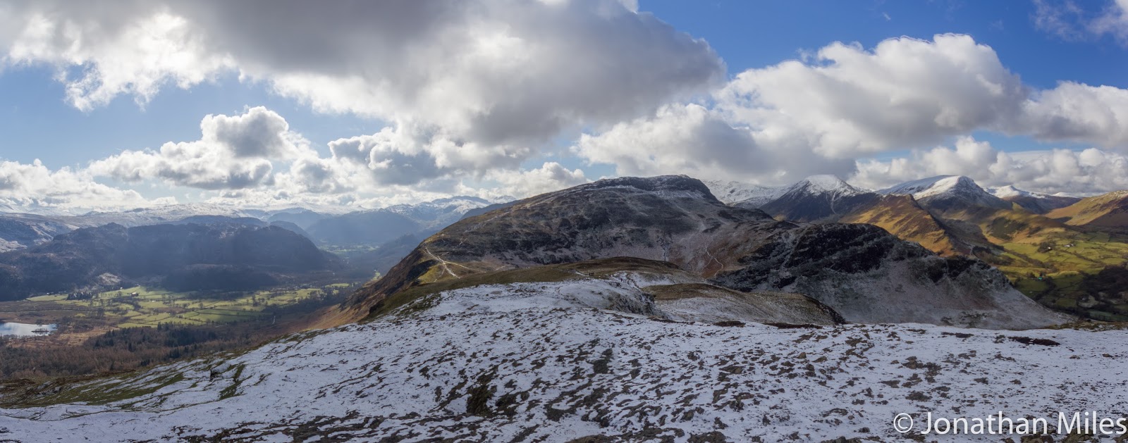
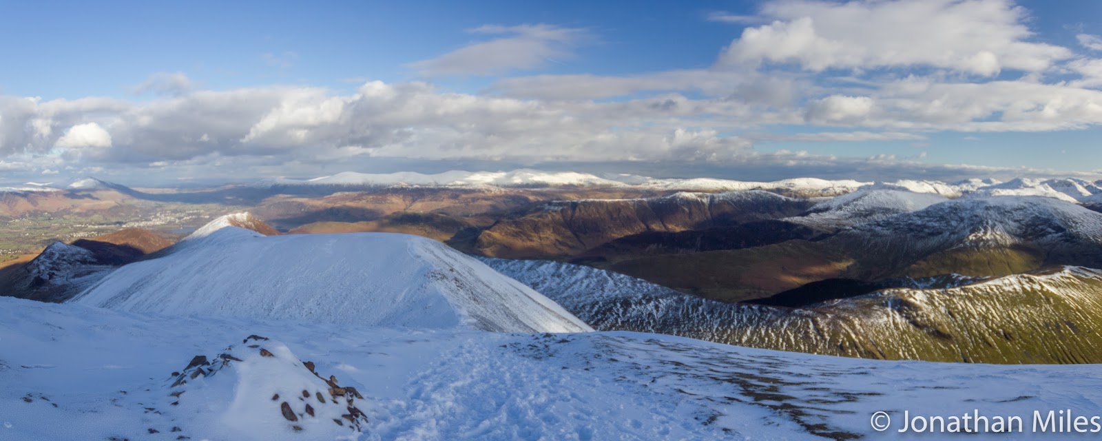
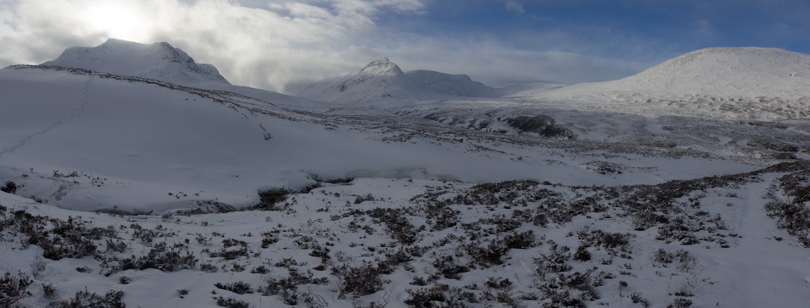
Looking down the gentle slopes of Coire Raibeirt towards Beinn Mheadhoin its tors clearly visible against the skyline.

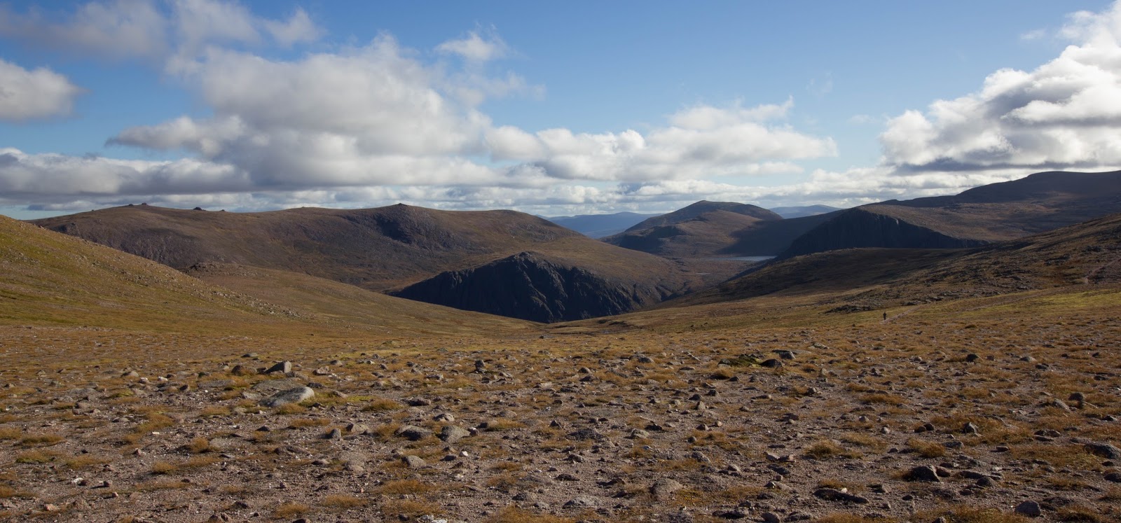
Having joined the path up to imaginatively named point 1141 which is perched on the shoulder of Cairn Gorm I follow a faint path across the plateau which drops down the gentle slopes of Coire Raibeirt picking up a small stream of tumbling water as it goes. Beinn Mheadhoin dominates the view whilst Loch Avon itself remains hidden in a deep trough ahead only becoming visible at the last minute as the path drops very steeply downwards out of the hanging corie towards the deep blue water. The decent is very steep and strenuous efforts have been made to build stairs down for much of the route saving what would be a pretty horrific scramble over loose rock although the path does eventually end up in the stream bed, no doubt the decent is a nightmare if coated in verglas in winter!

Towards the bottom I cross the stream and pick up another rough path which leads after much bolder hopping to the head on Loch Avon. The remoteness is palpable, a wild place with steep hills and crags on three sides with just the narrow opening to the north west containing the loch itself. The Feith Buidhe cascades down from high on the slopes of Ben Macdui and is crossed on stepping stones where it enters the Loch.

I make a short detour to visit the famous howff of the Shelter Stone one of hundreds of huge boulders that erosion has prized off the encircling crags which now lies across its neighbours creating a sheltered bivvy cave famous in Cairngorm mountaineering history as the base for many climbers exploring routes on the faces above. The shelter is one of many dotted throughout the bolder field no doubt welcome places to rest for those who brave these parts in the depths of winter, if they can find them in amongst the deep drifts of snow. 

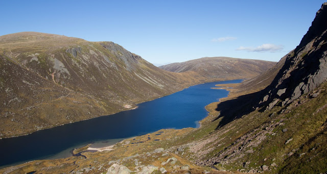
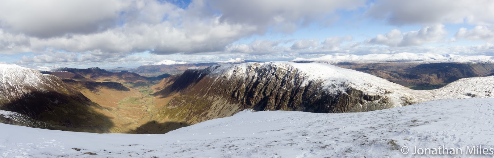
Loch Avon with the slope of Cairn Gorm behind.
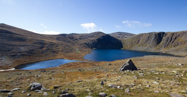
 Loch Etchachan

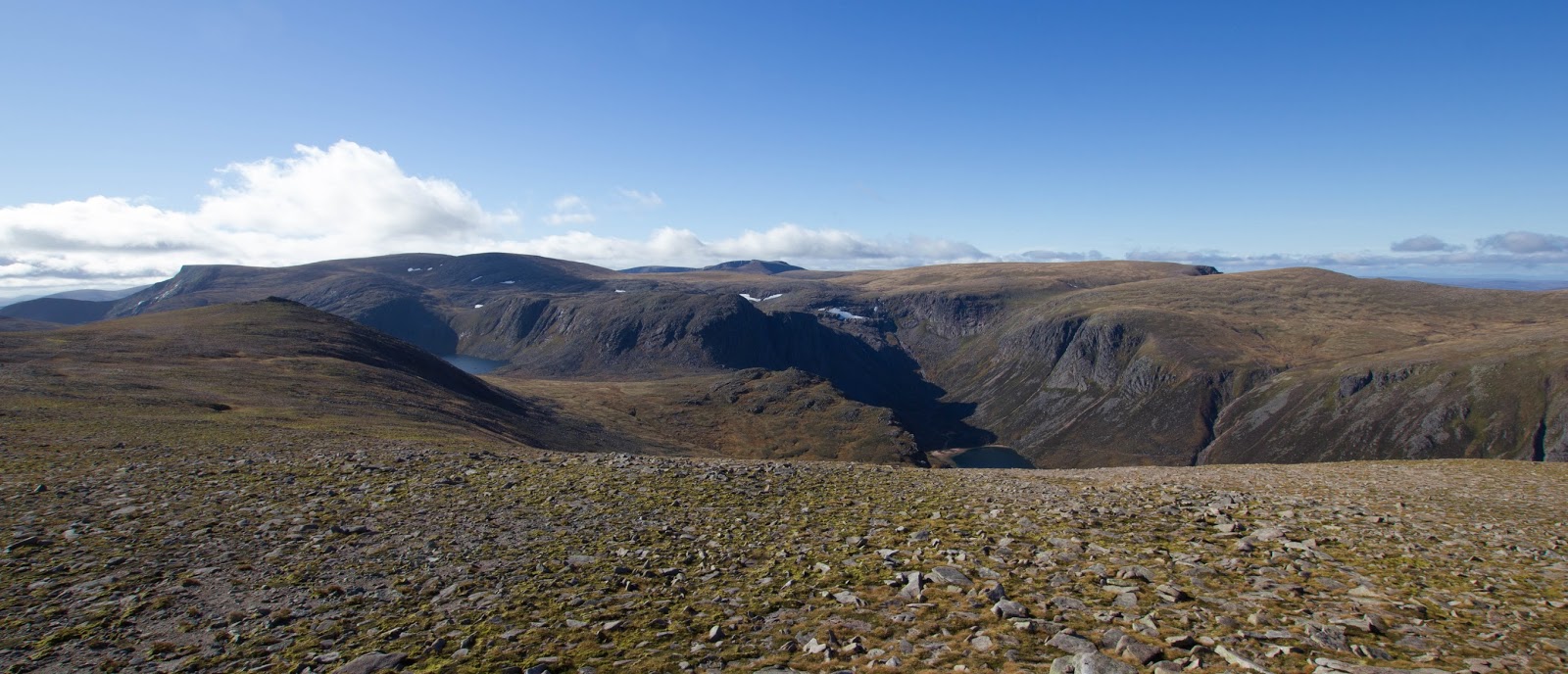
From the head of the loch a path climbs steeply to the col between Carn Etchachan and Beinn Mheadhoin, nestled just beyond this is Loch Etchachan the highest large body of water in the UK at over 900m above sea level; it looks a lovely place to camp in good weather surrounded by such awesome scenery. Just before the outflow of the loch I turn up the hillside to the northwest and climb steeply onto the summit plateau of Beinn Mheadhoin. The landscape is flat and stony with very little vegetation, a testament to the difficult year round conditions plant life faces clinging to life in the poor soil. 

The expanse of the summit is dominated by a series of high granite tors their sides wrinkled like old leather and the largest and highest of which proves to be the summit.  Having scrambled onto the top to me they almost almost justify inclusion alongside the Inn Pin as a Munro needing some climbing skills (but not ropes), certainly there are a couple of moves which would not be out of place on a v. diff

The three summit tors, the highest point being the central tor.

The view from the top is quite spectacular, for 360 degrees hills stretch out around you with no sign of roads, houses or the clutter of modern life, its a place to stop and savour just being in a landscape absorbing it in to enrich your soul before heading for home. I spend about half an hour playing about with my camera taking bracketed exposures to try and compensate for the contrast in light conditions which makes exposing both the brilliant blue sky and green brown earth a really chained even with a couple of graduated filters. Finally having had my fill of the view leaving the summit I retrace my steps back down to Loch Avon as the shadows of the day begin to lengthen.

Naturally having decended steeply this morning its a tough climb back the way I came onto the Cairngorm plateau but the babble of water keeps you company and refreshed. Loch Avon is certainly somewhere I would like to return to, perhaps trying to approach from the west and the Fords of Avon by bike or to explore with a packraft, but those are adventures for another day.

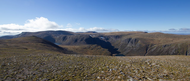
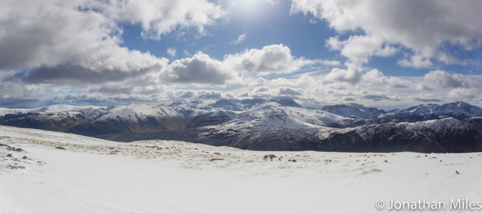
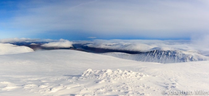
The view from just shy of the summit back to Loch Etchachan and Loch Avon, the count back to Cairn Gorm is the steep gully about a third of the way in from the left.

Arthington Viaduct

Another new location for me except this one is really close to home just off one of my usual cycle routes. I’ve always liked how the viaduct sits in the landscape but had assumed being lazy and not checking a map that it was not possible to get close. Earlier this week whilst looking at the map for other reasons I noted a short footpath runs alongside the River Wharfe so this morning headed down at 5:30 (horrible hour on a Sunday!).

The river was virtually mirror still with tendrils of mist rising from its surface giving a good reflection of the arches in the water. However I had the sun rapidly rising in the shot (need to learn to plan round this) and it was a bit too cloudy giving light that was nothing special but I could practice the composition and deploy two tricks to cheat the conditions.

My recent purchase of the big stopper allowed me to take a long exposure and give some blurring of sky and water (plus the swans which refused to leave the frame), the second strategy was to take three bracketed images over and under exposed by one stop and combine later in HDR.

Arthington Viaduct (1 of 3)

F7.1, 25 seconds with Lee Big Stopper

Arthington Viaduct (2 of 3)

Arthington Viaduct (3 of 3)

HDR of three images at F11

Ullswater Scouting Trip

I’m trying to scout at least one new location every week regardless of conditions so I have the spots in mind when the weather opportunities for good pictures arrive. This week I wild camped above Ullswater where there is a great view down the lake towards Hellvellyn. Both sunset and sunrise proved t be very hazy though so the images are not great, the best is below and shows the locations potential.

It was still good to sleep on top of a hill though, even if I did get the matches wet and have to start the morning sans tea!

Lakes (2 of 2)

Ullswater – Stitch of two images

Ben Alder Bike Mountaineering

There is an old adage that the more effort you put in to something the more you get out of it,  I must admit that this does not really occur to me as we saddle up and begin the long cycle in to the base of Ben Alder my mind distracted by the weight of ice axes crampons and four season boots jammed in my rucksack and upsetting the bikes centre of balance. It will certainly turn out to be true hours later when we arrive back at the car having traveled almost 45km on a day that does justice to one of the great hills of Scotland.

Ben Alder is a vast mountain; its high plateau remote, aloof, commanding a position in the heart of the Central Highlands.  Far from any road potential suitors must to commit to long approaches from Dhalwhinnie or Corrour just to get to the base of the mountains ridges and faces. In winter the mountain marshals short days and deep snow into its defensive vanguard each kilometre giving additional protection not given away easily, and for one of the finest mountains in Scotland it should always be this way.

It’s the middle of February and for Dom and I the only hope of completing an accent in a single day was to make use of mountain bike and cycle as far as Culra bothy (currently closed after an asbestos survey) which is reachable after a trip of some 15km on landcover tracks. Leaving the bikes here we hoped to climb one of the ridges that radiate out from the western edge of the plateau before returning to the bikes by the other. The ridges known as the Long and Short Leachas these are rumoured to give a good grade 1 expedition in winter although few appear to put in the effort to approach.

Under a full cover of snow anything short of a fat bike would probably be defeated but fortunately we have caught the weather at just the right time, a slight thaw has stripped the snow from below about 550m and most of the approach is clear although a hard frost has left the ground well frozen. The landcover track follows the northern shore of the Loch  Etrict closely, the sky is dull grey and overcast and the waters a cold unfriendly blue. To the south the northern ramparts of Creag Dhubh fall steeply into the loch, lonely and steep looking icefalls cascade down the crags so remote I doubt they see one visitor a year.

Adler (3 of 3)

Loch Pattack from the estate track, the path leads right from this point.

Cycling with heavy packs is not as hard as I expected or perhaps its all those miles on the road bike commuting to work through winter that have desensitised me to the effort. The first seven or eight km beside the loch are relatively level and its not until the track turns north at Ben Alder Lodge  a faux baronial chateau built to service the super rich that the real climbing up to remote Loch Pattack begins. Even this is not too steep and my legs tap out a good tempo as we leave the trees behind and emerge into the open hanging valley which sits above the lodge. 

It is possible to reach the bothy by following the landrover track all the way but where it passes the southern shores of Loch Pattack it is often underwater even in summer and if not a deep ford or wobbly cable bridge must be navigated on the bike. A much better alternative is to take a right down a good path a couple of hundred meters after were the track levels out and the loch first comes into view. This path would be difficult to find under snow but today its firm and disappears easily under the wheels of a bike as Ben Alder and the Leachas ridges slowly come into view.


Just before we reach Culra the path crosses the Allt a’ Chaoil-reidhe which is flowing quickly with little sign of ice, a testament to the past few days rising temperatures. Arriving at the bothy its covered in warning signs and beginning to look a bit sorry for itself coverd in warnings not to enter. However tempting the shelter is we take note and hide the bikes and change outside in the wind into our winter gear.


Looking up a very snowy Long Leachas in full white out conditions.


Following the path along the river the snow is generally well packed and the going easy, this changes as soon as we gingerly cross onto the southern side just after the junction with the Allt a’ Bhealaich Bheithe. There is no bridge or neat stepping stones and you have to make use of what rocks come your way; slipping over here would certainly not be a good plan.


The ridge itself is lost in the cloud above us but the spur on which is sits is an obvious landmark to aim for. The snow morphs from firm neve blasted hard by the wind upon which the crampons bite greedy to deep powder in which they wallow seeking purchase. It’s a pattern which alternates back and forth in a random patchwork across the hillside driven by the subtle differences in the texture of the landscape as it dances with the wind.


Generally its possible to weave the firmer sections together until we find ourselves on the ridge at which point it becomes obvious that the wind has deposited large amounts of powder for us to post hole through. At least the navigation is easy, if you fall off you are not on the route; however the ridge line is generally rounded until it narrows in its upper section with a number of steep rocky steps most buried by snow.


The narrower upper section of the Long Leachas as we timed our arrival at the top with the parting of the clouds.


From the top of the ridge where it meets the shoulder of the mountain its a good 1.5 kilometres and 150m of accent to the summit which would certainly would have been challenging to find if the cloud had not lifted just as we arrived. Marching south before swinging to the south east we are careful not to stray too close to the eastern face of the mountain which falls almost sheer for 300m and must be heavily corniced. 


A chill wind continues to push the clouds out the way giving flashes of blue sky and sending sunlight dappling across the snow bound plateau. As it clears the landscape offers up  glimpses of neighbouring peaks which drift in and out of view like great ships lost in banks of fog. It takes much longer to reach the summit than expected even though we can see virtually throughout only slowly drawing in such is the scale of  Ben Alder’s plateau.   

Adler (1 of 3)

Looking east toward loch Etrict and our start point almost almost out of view at the head of the Loch.

Adler (2 of 3)

Losing hight on the Short Leachas with a frozen Loch na Bhealaich Bheithe with the munro of Benn Bheoil behind.

Retracing our steps we reach the top of our decent route the slightly shorter version of the Long Leachas which is helpfully called the Short Leachas just in case you get the two muckstip. We had caught a fleeting glimpse of it on the way up, a perfect alpine esque ridge through a window in the thinning cloud. Now with the clouds lifted it’s revealed in its glory as a delicate snow aerate weaving its way down the mountain in a series of delicate cornices.

With a bit of care its a joy to descend, the view in front opens out giving a stunning panorama over a frozen Loch na Bhealaich Bheithe with the munro of Benn Bheoil behind. There is a huge sense of space as if one is decending into a void with the vast eastern face of Ben Alder stretching away to the left and right as you walk down this narrow line of white suspended in the sky. Sunbeams breaking through the clouds catch the gullies, ridges, and faces of the surrounding peaks causing them to glow with transient glory before the door closes and the light moves on. 

Looking back up the corniced ridge of the Short Leachas, certainly the highlight of the trip and great value for the grade in these conditions.

Reasons to return; Ben Alder and its ridges (left) and the equally brilliant Sgor Iuthan (centre) with Geal Charn behind and the rounded Carn Dearg (right)

Having descended from the airy beauty of the ridge its a bit of a shock to be back on the flat with a long snow slog back to the bikes; although gently downhill the miles in soft snow are beginning to tell in the legs and there is another river crossing to deal with to get across the Allt na Bhealaich Bheithe. Following the river for a while we find a crossing point after about fifteen minutes, carefully stepping from rock to rock as the ice cold water tumbles between them.

At the bikes the last of the coffee is drained from the flask before crampons, boots, and axes go back in the bag with the heavy winter waterproofs, to be replaced by lightweight cycling shoes (perhaps not the best choice).  Before leaving its compelling to take one last look at Ben Alder, already three kilometres away it sits majestic as the sun begins to slowly hide below its summit; the eye is also drawn to its neighbour Sgor Iuthan  and an equally fantastic looking ridge with descends from its summit.

Temperatures have risen during the day and the ground has started to thaw so the wheels don’t roll as easily as they did this morning but my 29er excels on this type of terrain, fast and smooth particularly when back on the estate road. Even with 40 plus kilometres in the legs I feel full of energy from the satisfaction of the day; a proper alpine experience in the UK and the feeling that we have had to really work for what we achieved. More importantly I feel we did one of the great mountains of Scotland justice. I will certainly return to this remote spot, the challenge of getting here makes the experience all the more rewarding.